This weather event on September 24, 2024 includes:
2 states
20 counties,
12 cities,
and 65 zip codes.
There were 1256 total properties that were impacted and have possible damage.
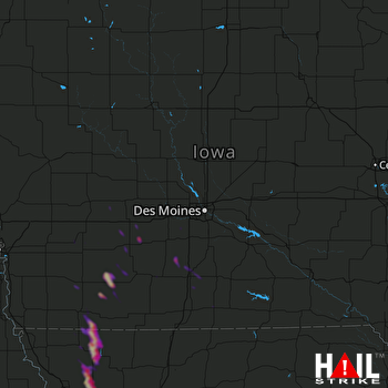 DES MOINES (KDMX) RADAR
States Impacted By Hail On September 24, 2024
Iowa
·
Missouri
Counties Impacted By Hail On September 24, 2024
Adair, IA
·
Adams, IA
·
Boone, IA
·
Cass, IA
·
Clarke, IA
·
Franklin, IA
·
Guthrie, IA
·
Iowa, IA
·
Madison, IA
·
Montgomery, IA
·
Page, IA
·
Tama, IA
·
Taylor, IA
·
Union, IA
·
Wayne, IA
·
Andrew, MO
·
Atchison, MO
·
Buchanan, MO
·
DeKalb, MO
·
Nodaway, MO
Cities Impacted By Hail On September 24, 2024
Braddyville, IA
·
Burlington Junction, MO
·
Clarinda, IA
·
Corning, IA
·
East Peru, IA
·
Hopkins, MO
·
Maryville, MO
·
Pickering, MO
·
Prescott, IA
·
Savannah, MO
·
Sharpsburg, IA
·
Stanton, IA
Zip Codes Impacted By Hail On September 24, 2024
50006
·
50022
·
50048
·
50061
·
50070
·
50115
·
50123
·
50149
·
50164
·
50174
·
50212
·
50213
·
50222
·
50250
·
50257
·
50261
·
50264
·
50274
·
50275
·
50675
·
50801
·
50830
·
50833
·
50837
·
50841
·
50843
·
50846
·
50849
·
50851
·
50853
·
50857
·
50858
·
50859
·
50862
·
50864
·
51544
·
51573
·
51631
·
51632
·
51646
·
52342
·
52347
·
64421
·
64423
·
64427
·
64428
·
64430
·
64431
·
64434
·
64436
·
64443
·
64445
·
64449
·
64455
·
64459
·
64461
·
64468
·
64476
·
64480
·
64483
·
64485
·
64487
·
64494
·
50002
·
50126

