This weather event on September 22, 2024 includes:
5 states
26 counties,
17 cities,
and 77 zip codes.
There were 12 total properties that were impacted and have possible damage.
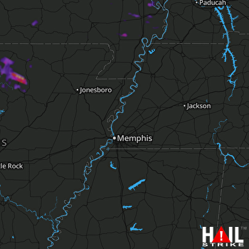 MEMPHIS (KNQA) RADAR
States Impacted By Hail On September 22, 2024
Arkansas
·
Illinois
·
Kentucky
·
Missouri
·
Tennessee
Counties Impacted By Hail On September 22, 2024
Baxter, AR
·
Clay, AR
·
Fulton, AR
·
Independence, AR
·
Izard, AR
·
Sharp, AR
·
Stone, AR
·
Alexander, IL
·
Massac, IL
·
Pulaski, IL
·
Ballard, KY
·
Fulton, KY
·
McCracken, KY
·
Bollinger, MO
·
Butler, MO
·
Carter, MO
·
Dunklin, MO
·
Mississippi, MO
·
New Madrid, MO
·
Oregon, MO
·
Ripley, MO
·
Scott, MO
·
Stoddard, MO
·
Wayne, MO
·
Lake, TN
·
Obion, TN
Cities Impacted By Hail On September 22, 2024
Bernie, MO
·
Bertrand, MO
·
Charleston, MO
·
Cherokee Village, AR
·
Cushman, AR
·
Fifty-Six, AR
·
Guion, AR
·
Highland, AR
·
Horseshoe Bend, AR
·
Melbourne, AR
·
Mount Pleasant, AR
·
Oxford, AR
·
Parma, MO
·
Pineville, AR
·
Pinhook, MO
·
Sidney, AR
·
Sikeston, MO
Zip Codes Impacted By Hail On September 22, 2024
38079
·
38261
·
42050
·
42053
·
62908
·
62914
·
62941
·
62956
·
62962
·
62969
·
62988
·
63735
·
63736
·
63763
·
63801
·
63822
·
63823
·
63825
·
63833
·
63834
·
63841
·
63846
·
63860
·
63862
·
63863
·
63867
·
63869
·
63870
·
63901
·
63933
·
63935
·
63945
·
63954
·
63960
·
63961
·
63965
·
65438
·
65606
·
65791
·
72454
·
72461
·
72501
·
72512
·
72513
·
72515
·
72517
·
72519
·
72521
·
72526
·
72528
·
72529
·
72531
·
72532
·
72533
·
72536
·
72539
·
72540
·
72554
·
72556
·
72560
·
72561
·
72565
·
72566
·
72573
·
72576
·
72577
·
72583
·
72584
·
72585
·
72587
·
72617
·
72658
·
72663
·
72680
·
63787
·
63845
·
72542

