This weather event on September 22, 2024 includes:
4 states
24 counties,
17 cities,
and 54 zip codes.
There were 1622 total properties that were impacted and have possible damage.
States Impacted By Hail On September 22, 2024
Illinois
·
Kentucky
·
Missouri
·
Tennessee
Counties Impacted By Hail On September 22, 2024
Alexander, IL
·
Hardin, IL
·
Johnson, IL
·
Massac, IL
·
Pope, IL
·
Pulaski, IL
·
Ballard, KY
·
Carlisle, KY
·
Crittenden, KY
·
Fulton, KY
·
Hickman, KY
·
Hopkins, KY
·
Livingston, KY
·
McCracken, KY
·
Muhlenberg, KY
·
Ohio, KY
·
Union, KY
·
Webster, KY
·
Mississippi, MO
·
New Madrid, MO
·
Scott, MO
·
Stoddard, MO
·
Lake, TN
·
Obion, TN
Cities Impacted By Hail On September 22, 2024
Blandville, KY
·
Breckinridge Center, KY
·
Carrsville, KY
·
Elizabethtown, IL
·
Farley, KY
·
Golconda, IL
·
Greenville, KY
·
Joppa, IL
·
Massac, KY
·
Morganfield, KY
·
Paducah, KY
·
Parma, MO
·
Rosiclare, IL
·
Sikeston, MO
·
Tolu, KY
·
Union City, TN
·
Wyatt, MO
Zip Codes Impacted By Hail On September 22, 2024
38079
·
38261
·
42001
·
42003
·
42021
·
42023
·
42024
·
42031
·
42047
·
42053
·
42056
·
42064
·
42078
·
42081
·
42084
·
42087
·
42344
·
42345
·
42349
·
42409
·
42431
·
42437
·
42455
·
42456
·
42462
·
62908
·
62910
·
62914
·
62919
·
62931
·
62938
·
62941
·
62943
·
62953
·
62956
·
62960
·
62962
·
62964
·
62982
·
63735
·
63736
·
63801
·
63822
·
63823
·
63825
·
63834
·
63841
·
63845
·
63846
·
63867
·
63870
·
42464
·
42325
·
42050
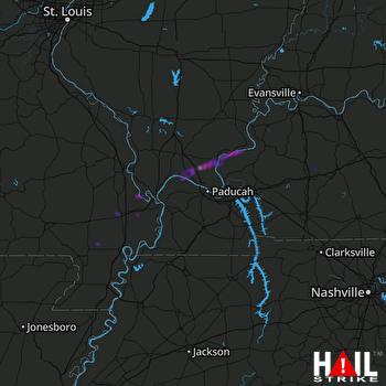 PADUCAH (KPAH) RADAR

