This weather event on September 21, 2024 includes:
4 states
29 counties,
17 cities,
and 71 zip codes.
There were 308 total properties that were impacted and have possible damage.
States Impacted By Hail On September 21, 2024
Illinois
·
Indiana
·
Kentucky
·
Tennessee
Counties Impacted By Hail On September 21, 2024
Bond, IL
·
Clinton, IL
·
Edwards, IL
·
Fayette, IL
·
Franklin, IL
·
Gallatin, IL
·
Hamilton, IL
·
Jefferson, IL
·
Perry, IL
·
Wabash, IL
·
Wayne, IL
·
White, IL
·
Gibson, IN
·
Posey, IN
·
Spencer, IN
·
Vanderburgh, IN
·
Breckinridge, KY
·
Butler, KY
·
Grayson, KY
·
Henderson, KY
·
Logan, KY
·
McLean, KY
·
Muhlenberg, KY
·
Ohio, KY
·
Union, KY
·
Warren, KY
·
Webster, KY
·
Sumner, TN
·
Wilson, TN
Cities Impacted By Hail On September 21, 2024
Bartelso, IL
·
Bremen, KY
·
Browns, IL
·
Carmi, IL
·
Dunmor, KY
·
Gallatin, TN
·
Henderson, KY
·
Hendersonville, TN
·
Hoffman, IL
·
Island, KY
·
Maunie, IL
·
Morgantown, KY
·
Poole, KY
·
Sebree, KY
·
Spottsville, KY
·
Springerton, IL
·
West Frankfort, IL
Zip Codes Impacted By Hail On September 21, 2024
37022
·
37066
·
37075
·
37122
·
42101
·
42256
·
42261
·
42325
·
42330
·
42339
·
42343
·
42350
·
42372
·
42406
·
42420
·
42437
·
42452
·
42455
·
42458
·
42461
·
47601
·
47613
·
47616
·
47620
·
47631
·
47633
·
47634
·
47638
·
47648
·
47665
·
47670
·
47712
·
62218
·
62231
·
62250
·
62253
·
62801
·
62806
·
62809
·
62810
·
62812
·
62818
·
62820
·
62821
·
62828
·
62830
·
62832
·
62835
·
62836
·
62837
·
62844
·
62859
·
62860
·
62861
·
62863
·
62867
·
62869
·
62874
·
62875
·
62883
·
62887
·
62889
·
62893
·
62895
·
62896
·
62979
·
62984
·
40119
·
42349
·
42456
·
62862
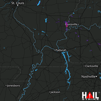 PADUCAH (KPAH) RADAR

