This weather event on September 21, 2024 includes:
4 states
28 counties,
9 cities,
and 63 zip codes.
There were total properties that were impacted and have possible damage.
States Impacted By Hail On September 21, 2024
Iowa
·
Illinois
·
Minnesota
·
Missouri
Counties Impacted By Hail On September 21, 2024
Appanoose, IA
·
Cedar, IA
·
Clayton, IA
·
Davis, IA
·
Des Moines, IA
·
Fayette, IA
·
Jefferson, IA
·
Johnson, IA
·
Lee, IA
·
Louisa, IA
·
Mahaska, IA
·
Monroe, IA
·
Muscatine, IA
·
Van Buren, IA
·
Winneshiek, IA
·
Mercer, IL
·
Rock Island, IL
·
Faribault, MN
·
Adair, MO
·
Caldwell, MO
·
Clark, MO
·
Knox, MO
·
Linn, MO
·
Macon, MO
·
Putnam, MO
·
Schuyler, MO
·
Scotland, MO
·
Sullivan, MO
Cities Impacted By Hail On September 21, 2024
Birmingham, IA
·
Calmar, IA
·
Fruitland, IA
·
Keosauqua, IA
·
Memphis, MO
·
Mount Sterling, IA
·
Muscatine, IA
·
Ossian, IA
·
Worthington, MO
Zip Codes Impacted By Hail On September 21, 2024
52047
·
52072
·
52101
·
52132
·
52133
·
52144
·
52156
·
52161
·
52162
·
52175
·
52535
·
52542
·
52543
·
52551
·
52554
·
52560
·
52561
·
52565
·
52567
·
52571
·
52573
·
52574
·
52581
·
52588
·
52620
·
52626
·
52630
·
52637
·
52646
·
52653
·
52721
·
52738
·
52739
·
52747
·
52749
·
52754
·
52755
·
52761
·
52772
·
52778
·
56068
·
56097
·
61259
·
61272
·
63432
·
63453
·
63460
·
63501
·
63533
·
63538
·
63544
·
63545
·
63546
·
63547
·
63549
·
63555
·
63557
·
63559
·
63561
·
63565
·
63567
·
64625
·
64644
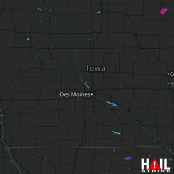 DES MOINES (KDMX) RADAR

