This weather event on September 21, 2024 includes:
2 states
21 counties,
16 cities,
and 54 zip codes.
There were 55 total properties that were impacted and have possible damage.
States Impacted By Hail On September 21, 2024
Kansas
·
Missouri
Counties Impacted By Hail On September 21, 2024
Franklin, KS
·
Linn, KS
·
Miami, KS
·
Osage, KS
·
Wabaunsee, KS
·
Barton, MO
·
Bates, MO
·
Caldwell, MO
·
Cass, MO
·
Cedar, MO
·
Clay, MO
·
Dade, MO
·
Henry, MO
·
Jackson, MO
·
Johnson, MO
·
Lafayette, MO
·
Pettis, MO
·
Ray, MO
·
Saline, MO
·
St. Clair, MO
·
Vernon, MO
Cities Impacted By Hail On September 21, 2024
Amsterdam, MO
·
Creighton, MO
·
Crystal Lakes, MO
·
Deepwater, MO
·
Elmira, MO
·
Excelsior Springs, MO
·
Higginsville, MO
·
Homestead, MO
·
Levasy, MO
·
Lexington, MO
·
Linn Valley, KS
·
Missouri City, MO
·
Orrick, MO
·
Osawatomie, KS
·
Polo, MO
·
Wood Heights, MO
Zip Codes Impacted By Hail On September 21, 2024
64016
·
64020
·
64021
·
64024
·
64037
·
64058
·
64062
·
64067
·
64068
·
64071
·
64072
·
64074
·
64077
·
64088
·
64093
·
64097
·
64465
·
64671
·
64720
·
64722
·
64723
·
64724
·
64730
·
64735
·
64739
·
64740
·
64742
·
64744
·
64747
·
64750
·
64756
·
64759
·
64779
·
64780
·
64788
·
64790
·
65321
·
65336
·
65351
·
65603
·
65682
·
66014
·
66040
·
66056
·
66064
·
66071
·
66075
·
66078
·
66095
·
66413
·
66431
·
64001
·
64066
·
66053
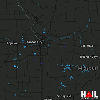 KANSAS CITY (KEAX) RADAR

