This weather event on September 20, 2024 includes:
2 states
20 counties,
25 cities,
and 63 zip codes.
There were total properties that were impacted and have possible damage.
States Impacted By Hail On September 20, 2024
Illinois
·
Indiana
Counties Impacted By Hail On September 20, 2024
Clark, IL
·
Edgar, IL
·
Jasper, IL
·
Lawrence, IL
·
Richland, IL
·
Wabash, IL
·
Clay, IN
·
Hendricks, IN
·
Johnson, IN
·
Knox, IN
·
Marion, IN
·
Monroe, IN
·
Morgan, IN
·
Owen, IN
·
Parke, IN
·
Putnam, IN
·
Shelby, IN
·
Sullivan, IN
·
Vermillion, IN
·
Vigo, IN
Cities Impacted By Hail On September 20, 2024
Bloomington, IN
·
Brazil, IN
·
Clayton, IN
·
Cloverdale, IN
·
Crows Nest, IN
·
Ellettsville, IN
·
Fontanet, IN
·
Gosport, IN
·
Greenwood, IN
·
Indianapolis city (balance), IN
·
Marshall, IL
·
Meridian Hills, IN
·
New Goshen, IN
·
Newton, IL
·
North Crows Nest, IN
·
North Terre Haute, IN
·
Pittsboro, IN
·
Ragsdale, IN
·
Rocky Ripple, IN
·
Rosedale, IN
·
Shelburn, IN
·
Shepardsville, IN
·
Southport, IN
·
Sumner, IL
·
Tecumseh, IN
Zip Codes Impacted By Hail On September 20, 2024
46110
·
46112
·
46113
·
46118
·
46120
·
46121
·
46126
·
46128
·
46131
·
46135
·
46142
·
46143
·
46158
·
46167
·
46168
·
46171
·
46183
·
46184
·
46208
·
46220
·
46221
·
46227
·
46228
·
46237
·
46254
·
46259
·
46260
·
46268
·
46278
·
47404
·
47429
·
47433
·
47456
·
47460
·
47512
·
47516
·
47591
·
47805
·
47849
·
47863
·
47868
·
47874
·
47879
·
47882
·
47885
·
61944
·
62410
·
62419
·
62421
·
62423
·
62432
·
62441
·
62442
·
62448
·
62460
·
62466
·
62475
·
62476
·
62479
·
62863
·
46217
·
47834
·
47842
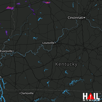 LOUISVILLE (KLVX) RADAR

