This weather event on September 19, 2024 includes:
2 states
20 counties,
27 cities,
and 70 zip codes.
There were 2777 total properties that were impacted and have possible damage.
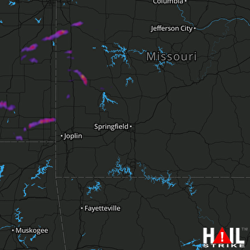 SPRINGFIELD (KSGF) RADAR
States Impacted By Hail On September 19, 2024
Kansas
·
Missouri
Counties Impacted By Hail On September 19, 2024
Anderson, KS
·
Cherokee, KS
·
Coffey, KS
·
Crawford, KS
·
Labette, KS
·
Linn, KS
·
Miami, KS
·
Neosho, KS
·
Wilson, KS
·
Woodson, KS
·
Barton, MO
·
Bates, MO
·
Cass, MO
·
Cedar, MO
·
Hickory, MO
·
Jasper, MO
·
Johnson, MO
·
Polk, MO
·
St. Clair, MO
·
Vernon, MO
Cities Impacted By Hail On September 19, 2024
Altoona, KS
·
Bartlett, KS
·
Butler, MO
·
Cherokee, KS
·
Chilhowee, MO
·
Drexel, MO
·
East Lynne, MO
·
Fontana, KS
·
Garnett, KS
·
Greeley, KS
·
Gunn City, MO
·
Harrisonville, MO
·
Harwood, MO
·
Humansville, MO
·
Labette, KS
·
Louisburg, KS
·
Neodesha, KS
·
Nevada, MO
·
Parker, KS
·
Pittsburg, KS
·
Roseland, KS
·
Scammon, KS
·
Thayer, KS
·
Walker, MO
·
Weir, KS
·
West Mineral, KS
·
Yates Center, KS
Zip Codes Impacted By Hail On September 19, 2024
64040
·
64061
·
64080
·
64701
·
64725
·
64726
·
64730
·
64733
·
64734
·
64739
·
64742
·
64743
·
64744
·
64747
·
64750
·
64759
·
64762
·
64772
·
64776
·
64778
·
64779
·
64780
·
64783
·
64784
·
64790
·
64832
·
65674
·
65785
·
66010
·
66014
·
66026
·
66032
·
66033
·
66039
·
66040
·
66042
·
66053
·
66056
·
66064
·
66071
·
66072
·
66091
·
66710
·
66720
·
66724
·
66725
·
66733
·
66736
·
66740
·
66757
·
66760
·
66762
·
66773
·
66776
·
66777
·
66781
·
66782
·
66783
·
67047
·
67330
·
67332
·
67336
·
67342
·
67354
·
67356
·
64728
·
64746
·
66753
·
66857
·
67357

