This weather event on September 19, 2024 includes:
4 states
26 counties,
17 cities,
and 80 zip codes.
There were 308 total properties that were impacted and have possible damage.
States Impacted By Hail On September 19, 2024
Iowa
·
Kansas
·
Missouri
·
Nebraska
Counties Impacted By Hail On September 19, 2024
Fremont, IA
·
Mills, IA
·
Montgomery, IA
·
Page, IA
·
Allen, KS
·
Atchison, KS
·
Brown, KS
·
Doniphan, KS
·
Douglas, KS
·
Franklin, KS
·
Greenwood, KS
·
Jackson, KS
·
Jefferson, KS
·
Johnson, KS
·
Leavenworth, KS
·
Nemaha, KS
·
Neosho, KS
·
Shawnee, KS
·
Wabaunsee, KS
·
Woodson, KS
·
Wyandotte, KS
·
Andrew, MO
·
Holt, MO
·
Platte, MO
·
Cass, NE
·
Otoe, NE
Cities Impacted By Hail On September 19, 2024
Basehor, KS
·
Blanchard, IA
·
Delia, KS
·
Farley, MO
·
Gardner, KS
·
Hamilton, KS
·
Hoyt, KS
·
Kansas City, KS
·
Lansing, KS
·
Leavenworth, KS
·
Malvern, IA
·
Meriden, KS
·
Parkville, MO
·
Rossville, KS
·
Savonburg, KS
·
Thurman, IA
·
Topeka, KS
Zip Codes Impacted By Hail On September 19, 2024
51540
·
51551
·
51561
·
51566
·
51630
·
51636
·
51638
·
51652
·
51653
·
51654
·
64018
·
64079
·
64092
·
64098
·
64152
·
64153
·
64421
·
64437
·
64439
·
64449
·
64451
·
64473
·
64484
·
64485
·
66002
·
66007
·
66020
·
66025
·
66030
·
66043
·
66048
·
66054
·
66061
·
66066
·
66067
·
66070
·
66078
·
66086
·
66087
·
66094
·
66095
·
66097
·
66109
·
66428
·
66434
·
66507
·
66509
·
66512
·
66526
·
66532
·
66533
·
66539
·
66603
·
66604
·
66606
·
66607
·
66608
·
66612
·
66615
·
66616
·
66617
·
66618
·
66720
·
66732
·
66733
·
66748
·
66772
·
66775
·
66783
·
66853
·
66870
·
68048
·
68410
·
68413
·
68455
·
51534
·
51648
·
66418
·
66440
·
66540
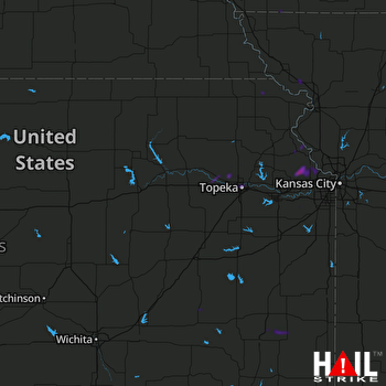 TOPEKA (KTWX) RADAR

