This weather event on September 19, 2024 includes:
4 states
24 counties,
24 cities,
and 77 zip codes.
There were total properties that were impacted and have possible damage.
States Impacted By Hail On September 19, 2024
Iowa
·
Minnesota
·
Nebraska
·
South Dakota
Counties Impacted By Hail On September 19, 2024
Calhoun, IA
·
Carroll, IA
·
Crawford, IA
·
Emmet, IA
·
Humboldt, IA
·
Ida, IA
·
Kossuth, IA
·
Monona, IA
·
Pocahontas, IA
·
Sac, IA
·
Webster, IA
·
Blue Earth, MN
·
Faribault, MN
·
Martin, MN
·
Nicollet, MN
·
Boyd, NE
·
Burt, NE
·
Cuming, NE
·
Dodge, NE
·
Holt, NE
·
Thurston, NE
·
Gregory, SD
·
Hutchinson, SD
·
McCook, SD
Cities Impacted By Hail On September 19, 2024
Auburn, IA
·
Blue Earth, MN
·
Breda, IA
·
Clare, IA
·
Decatur, NE
·
Deloit, IA
·
Garden City, MN
·
Gross, NE
·
Ida Grove, IA
·
Kiron, IA
·
Lake City, IA
·
Lake View, IA
·
Manson, IA
·
Oakland, NE
·
Odebolt, IA
·
Onawa, IA
·
Ricketts, IA
·
Rockwell City, IA
·
Sac City, IA
·
Schleswig, IA
·
Twin Lakes, IA
·
Ute, IA
·
Wall Lake, IA
·
Yetter, IA
Zip Codes Impacted By Hail On September 19, 2024
50514
·
50517
·
50518
·
50519
·
50524
·
50531
·
50551
·
50556
·
50561
·
50563
·
50568
·
50570
·
50575
·
50583
·
50590
·
51006
·
51010
·
51019
·
51034
·
51040
·
51060
·
51401
·
51430
·
51431
·
51433
·
51436
·
51439
·
51441
·
51442
·
51445
·
51448
·
51449
·
51450
·
51453
·
51458
·
51461
·
51465
·
51466
·
51467
·
51523
·
51558
·
51572
·
56001
·
56003
·
56013
·
56023
·
56031
·
56034
·
56037
·
56055
·
56098
·
56121
·
56127
·
56181
·
57012
·
57043
·
57047
·
57319
·
57332
·
68019
·
68020
·
68031
·
68038
·
68045
·
68055
·
68057
·
68061
·
68713
·
68719
·
68746
·
68763
·
68766
·
68777
·
68788
·
50540
·
50579
·
56039
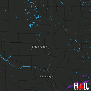 SIOUX FALLS (KFSD) RADAR

