This weather event on September 16, 2024 includes:
2 states
19 counties,
18 cities,
and 58 zip codes.
There were total properties that were impacted and have possible damage.
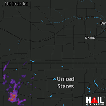 HASTINGS (KUEX) RADAR
States Impacted By Hail On September 16, 2024
Kansas
·
Nebraska
Counties Impacted By Hail On September 16, 2024
Barton, KS
·
Decatur, KS
·
Ellis, KS
·
Gove, KS
·
Graham, KS
·
Ness, KS
·
Norton, KS
·
Phillips, KS
·
Rooks, KS
·
Rush, KS
·
Sheridan, KS
·
Smith, KS
·
Trego, KS
·
Butler, NE
·
Colfax, NE
·
Furnas, NE
·
Harlan, NE
·
Lancaster, NE
·
Red Willow, NE
Cities Impacted By Hail On September 16, 2024
Alexander, KS
·
Bazine, KS
·
Clayton, KS
·
Collyer, KS
·
Dresden, KS
·
Hill City, KS
·
Lebanon, NE
·
Liebenthal, KS
·
Lincoln, NE
·
Logan, KS
·
McCracken, KS
·
Morland, KS
·
Oberlin, KS
·
Park, KS
·
Quinter, KS
·
Ransom, KS
·
Stockton, KS
·
Yankee Hill, NE
Zip Codes Impacted By Hail On September 16, 2024
67474
·
67511
·
67513
·
67516
·
67520
·
67521
·
67548
·
67553
·
67556
·
67560
·
67572
·
67575
·
67584
·
67601
·
67622
·
67625
·
67629
·
67631
·
67632
·
67635
·
67637
·
67639
·
67642
·
67643
·
67644
·
67645
·
67646
·
67647
·
67650
·
67651
·
67653
·
67654
·
67656
·
67657
·
67659
·
67661
·
67663
·
67669
·
67672
·
67675
·
67736
·
67737
·
67740
·
67749
·
67751
·
67752
·
67757
·
68036
·
68512
·
68522
·
68523
·
68661
·
68977
·
69020
·
69026
·
69034
·
69036
·
67559

