This weather event on September 16, 2024 includes:
3 states
21 counties,
15 cities,
and 63 zip codes.
There were total properties that were impacted and have possible damage.
States Impacted By Hail On September 16, 2024
Kansas
·
Nebraska
·
South Dakota
Counties Impacted By Hail On September 16, 2024
Jewell, KS
·
Adams, NE
·
Antelope, NE
·
Boone, NE
·
Boyd, NE
·
Cedar, NE
·
Clay, NE
·
Greeley, NE
·
Hall, NE
·
Hamilton, NE
·
Holt, NE
·
Howard, NE
·
Knox, NE
·
Merrick, NE
·
Nance, NE
·
Webster, NE
·
Wheeler, NE
·
Bon Homme, SD
·
Charles Mix, SD
·
Hutchinson, SD
·
Yankton, SD
Cities Impacted By Hail On September 16, 2024
Bartlett, NE
·
Cushing, NE
·
Grand Island, NE
·
Greeley Center, NE
·
Hastings, NE
·
Lesterville, SD
·
Monowi, NE
·
O'Neill, NE
·
Palmer, NE
·
Phillips, NE
·
Primrose, NE
·
Royal, NE
·
Spalding, NE
·
Springfield, SD
·
Wolbach, NE
Zip Codes Impacted By Hail On September 16, 2024
57040
·
57045
·
57059
·
57062
·
57063
·
57066
·
57315
·
57329
·
66936
·
66941
·
66956
·
68620
·
68622
·
68623
·
68627
·
68636
·
68637
·
68638
·
68655
·
68665
·
68718
·
68720
·
68724
·
68725
·
68726
·
68729
·
68735
·
68736
·
68739
·
68742
·
68746
·
68756
·
68760
·
68764
·
68766
·
68769
·
68771
·
68773
·
68783
·
68786
·
68789
·
68801
·
68818
·
68827
·
68832
·
68841
·
68842
·
68864
·
68865
·
68872
·
68873
·
68875
·
68882
·
68901
·
68928
·
68930
·
68941
·
68944
·
68952
·
68954
·
68970
·
68980
·
68763
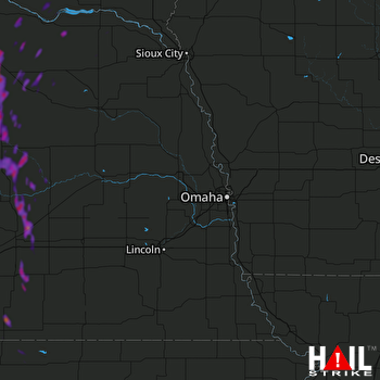 OMAHA (KOAX) RADAR

