This weather event on August 29, 2024 includes:
1 states
13 counties,
24 cities,
and 63 zip codes.
There were total properties that were impacted and have possible damage.
States Impacted By Hail On August 29, 2024
Indiana
Counties Impacted By Hail On August 29, 2024
Boone, IN
·
Brown, IN
·
Hancock, IN
·
Hendricks, IN
·
Johnson, IN
·
Madison, IN
·
Marion, IN
·
Montgomery, IN
·
Morgan, IN
·
Parke, IN
·
Putnam, IN
·
Shelby, IN
·
Vermillion, IN
Cities Impacted By Hail On August 29, 2024
Avon, IN
·
Bainbridge, IN
·
Bargersville, IN
·
Beech Grove, IN
·
Brownsburg, IN
·
Clermont, IN
·
Crows Nest, IN
·
Franklin, IN
·
Greenwood, IN
·
Homecroft, IN
·
Indianapolis city (balance), IN
·
Lawrence, IN
·
Meridian Hills, IN
·
Montezuma, IN
·
New Palestine, IN
·
North Crows Nest, IN
·
Rocky Ripple, IN
·
Southport, IN
·
Spring Hill, IN
·
Trafalgar, IN
·
Whiteland, IN
·
Whitestown, IN
·
Williams Creek, IN
·
Zionsville, IN
Zip Codes Impacted By Hail On August 29, 2024
46040
·
46064
·
46075
·
46077
·
46105
·
46106
·
46107
·
46110
·
46112
·
46113
·
46120
·
46121
·
46122
·
46123
·
46128
·
46131
·
46135
·
46140
·
46142
·
46143
·
46147
·
46151
·
46158
·
46160
·
46162
·
46163
·
46172
·
46181
·
46184
·
46186
·
46201
·
46202
·
46205
·
46208
·
46214
·
46217
·
46218
·
46219
·
46220
·
46222
·
46224
·
46225
·
46226
·
46227
·
46228
·
46231
·
46234
·
46237
·
46240
·
46250
·
46254
·
46256
·
46259
·
46260
·
46268
·
46278
·
47854
·
47862
·
47933
·
47968
·
46239
·
46221
·
46203
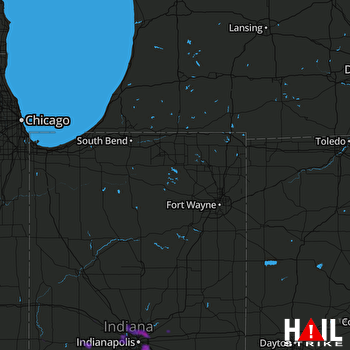 FORT WAYNE (KIWX) RADAR

