This weather event on August 29, 2024 includes:
2 states
29 counties,
12 cities,
and 69 zip codes.
There were 269 total properties that were impacted and have possible damage.
States Impacted By Hail On August 29, 2024
Colorado
·
Kansas
Counties Impacted By Hail On August 29, 2024
Baca, CO
·
Cheyenne, CO
·
Prowers, CO
·
Ellis, KS
·
Finney, KS
·
Ford, KS
·
Gove, KS
·
Graham, KS
·
Grant, KS
·
Gray, KS
·
Greeley, KS
·
Hamilton, KS
·
Haskell, KS
·
Hodgeman, KS
·
Kearny, KS
·
Lane, KS
·
Morton, KS
·
Ness, KS
·
Norton, KS
·
Pawnee, KS
·
Phillips, KS
·
Rooks, KS
·
Rush, KS
·
Scott, KS
·
Sheridan, KS
·
Smith, KS
·
Stanton, KS
·
Trego, KS
·
Wichita, KS
Cities Impacted By Hail On August 29, 2024
Agra, KS
·
Collyer, KS
·
Garden City, KS
·
Greeley County unified government (balance), KS
·
Holcomb, KS
·
Ingalls, KS
·
Phillipsburg, KS
·
Quinter, KS
·
Satanta, KS
·
Stockton, KS
·
Sublette, KS
·
Syracuse, KS
Zip Codes Impacted By Hail On August 29, 2024
66951
·
67513
·
67518
·
67523
·
67548
·
67556
·
67559
·
67560
·
67572
·
67575
·
67584
·
67601
·
67621
·
67625
·
67631
·
67632
·
67637
·
67639
·
67644
·
67645
·
67646
·
67650
·
67656
·
67657
·
67659
·
67661
·
67663
·
67664
·
67669
·
67672
·
67675
·
67736
·
67738
·
67740
·
67752
·
67801
·
67835
·
67836
·
67837
·
67838
·
67839
·
67841
·
67846
·
67850
·
67851
·
67853
·
67854
·
67855
·
67857
·
67860
·
67861
·
67862
·
67863
·
67867
·
67870
·
67871
·
67877
·
67878
·
67879
·
67880
·
67953
·
80802
·
81047
·
81090
·
67954
·
67868
·
67642
·
67574
·
67515
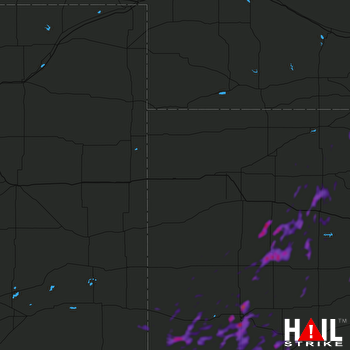 GOODLAND (KGLD) RADAR

