This weather event on August 28, 2024 includes:
1 states
29 counties,
21 cities,
and 80 zip codes.
There were 445 total properties that were impacted and have possible damage.
States Impacted By Hail On August 28, 2024
Texas
Counties Impacted By Hail On August 28, 2024
Anderson, TX
·
Baylor, TX
·
Bell, TX
·
Brown, TX
·
Burnet, TX
·
Cherokee, TX
·
Coleman, TX
·
Comanche, TX
·
Coryell, TX
·
Erath, TX
·
Freestone, TX
·
Henderson, TX
·
Houston, TX
·
Kaufman, TX
·
Leon, TX
·
Llano, TX
·
Madison, TX
·
McCulloch, TX
·
Milam, TX
·
Robertson, TX
·
San Saba, TX
·
Shackelford, TX
·
Smith, TX
·
Stephens, TX
·
Throckmorton, TX
·
Upshur, TX
·
Van Zandt, TX
·
Williamson, TX
·
Wood, TX
Cities Impacted By Hail On August 28, 2024
Athens, TX
·
Belton, TX
·
Berryville, TX
·
Buchanan Dam, TX
·
Coffee City, TX
·
Elkhart, TX
·
Emerald Bay, TX
·
Gilmer, TX
·
Gladewater, TX
·
Grapeland, TX
·
Gun Barrel City, TX
·
Holland, TX
·
Holly Lake Ranch, TX
·
Latexo, TX
·
Leona, TX
·
Lindale, TX
·
Moore Station, TX
·
Payne Springs, TX
·
Poynor, TX
·
Shadybrook, TX
·
Whitehouse, TX
Zip Codes Impacted By Hail On August 28, 2024
75644
·
75835
·
75853
·
76444
·
76525
·
76534
·
76566
·
76569
·
75103
·
75124
·
75142
·
75143
·
75147
·
75156
·
75410
·
75494
·
75640
·
75645
·
75647
·
75683
·
75703
·
75706
·
75751
·
75752
·
75755
·
75756
·
75757
·
75758
·
75762
·
75763
·
75765
·
75766
·
75770
·
75771
·
75773
·
75778
·
75783
·
75791
·
75801
·
75803
·
75831
·
75833
·
75839
·
75844
·
75846
·
75849
·
75850
·
75851
·
75852
·
75855
·
75861
·
76380
·
76401
·
76424
·
76430
·
76442
·
76446
·
76453
·
76483
·
76513
·
76518
·
76519
·
76520
·
76570
·
76574
·
76827
·
76834
·
76871
·
76872
·
77837
·
77856
·
77859
·
77864
·
77871
·
78607
·
78609
·
78615
·
78643
·
78654
·
79538
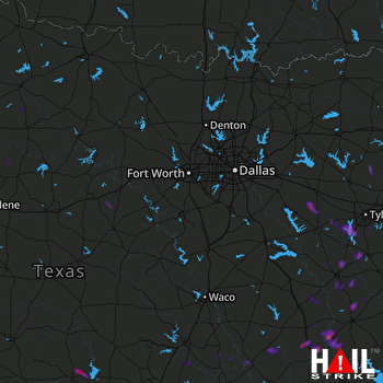 DALLAS/FTW (KFWS) RADAR

