This weather event on August 28, 2024 includes:
3 states
25 counties,
16 cities,
and 66 zip codes.
There were 117 total properties that were impacted and have possible damage.
States Impacted By Hail On August 28, 2024
Illinois
·
Indiana
·
Missouri
Counties Impacted By Hail On August 28, 2024
Clay, IL
·
Coles, IL
·
Crawford, IL
·
Cumberland, IL
·
De Witt, IL
·
Edwards, IL
·
Ford, IL
·
Grundy, IL
·
Iroquois, IL
·
Kankakee, IL
·
Lawrence, IL
·
Lee, IL
·
Livingston, IL
·
Logan, IL
·
Richland, IL
·
Wabash, IL
·
Wayne, IL
·
Clay, IN
·
Greene, IN
·
Knox, IN
·
Sullivan, IN
·
Audrain, MO
·
Lincoln, MO
·
Montgomery, MO
·
Pike, MO
Cities Impacted By Hail On August 28, 2024
Albion, IL
·
Atlanta, IL
·
Bellmont, IL
·
Browns, IL
·
Cabery, IL
·
Carlisle, IN
·
Compton, IL
·
Dugger, IN
·
Flat Rock, IL
·
Herscher, IL
·
Jasonville, IN
·
Odell, IL
·
Palestine, IL
·
Paw Paw, IL
·
Sullivan, IN
·
West Salem, IL
Zip Codes Impacted By Hail On August 28, 2024
47438
·
47441
·
47561
·
47838
·
47848
·
47882
·
60420
·
60437
·
60460
·
60479
·
60518
·
60917
·
60922
·
60927
·
60934
·
60941
·
60946
·
61318
·
61353
·
61723
·
61727
·
61751
·
61764
·
61769
·
61778
·
61928
·
61938
·
62410
·
62413
·
62417
·
62419
·
62425
·
62427
·
62433
·
62439
·
62446
·
62447
·
62450
·
62451
·
62452
·
62454
·
62460
·
62466
·
62476
·
62478
·
62656
·
62806
·
62811
·
62818
·
62823
·
62824
·
62833
·
62842
·
62843
·
62844
·
62863
·
62868
·
63352
·
63359
·
63377
·
63382
·
63384
·
47861
·
60919
·
62815
·
63333
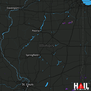 LINCOLN (KILX) RADAR

