This weather event on August 28, 2024 includes:
2 states
21 counties,
23 cities,
and 52 zip codes.
There were 460 total properties that were impacted and have possible damage.
States Impacted By Hail On August 28, 2024
Illinois
·
Missouri
Counties Impacted By Hail On August 28, 2024
Clay, IL
·
Crawford, IL
·
Edwards, IL
·
Fayette, IL
·
Franklin, IL
·
Hamilton, IL
·
Jackson, IL
·
Jefferson, IL
·
Lawrence, IL
·
Madison, IL
·
Marion, IL
·
Monroe, IL
·
Perry, IL
·
Richland, IL
·
St. Clair, IL
·
Wabash, IL
·
Washington, IL
·
Wayne, IL
·
Jefferson, MO
·
Ste. Genevieve, MO
·
St. Louis, MO
Cities Impacted By Hail On August 28, 2024
Arnold, MO
·
Ballwin, MO
·
Benton, IL
·
Browns, IL
·
Caseyville, IL
·
Centreville, IL
·
Cisne, IL
·
Columbia, IL
·
Dupo, IL
·
Du Quoin, IL
·
East St. Louis, IL
·
Ellisville, MO
·
Ewing, IL
·
Fairmont City, IL
·
Irvington, IL
·
Mehlville, MO
·
Nashville, IL
·
Oakville, MO
·
Salem, IL
·
St. Johns, IL
·
Washington Park, IL
·
Wildwood, MO
·
Winchester, MO
Zip Codes Impacted By Hail On August 28, 2024
62025
·
62061
·
62201
·
62203
·
62204
·
62205
·
62207
·
62236
·
62237
·
62238
·
62263
·
62268
·
62280
·
62419
·
62446
·
62451
·
62454
·
62466
·
62471
·
62810
·
62812
·
62818
·
62823
·
62824
·
62831
·
62832
·
62836
·
62839
·
62842
·
62846
·
62859
·
62863
·
62864
·
62868
·
62872
·
62878
·
62881
·
62884
·
62888
·
62890
·
62896
·
62907
·
62932
·
63010
·
63011
·
63021
·
63038
·
63129
·
63670
·
62897
·
62801
·
62274
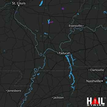 PADUCAH (KPAH) RADAR

