This weather event on August 27, 2024 includes:
1 states
29 counties,
12 cities,
and 50 zip codes.
There were total properties that were impacted and have possible damage.
States Impacted By Hail On August 27, 2024
Texas
Counties Impacted By Hail On August 27, 2024
Bandera, TX
·
Blanco, TX
·
Brown, TX
·
Burnet, TX
·
Callahan, TX
·
Coleman, TX
·
Concho, TX
·
Eastland, TX
·
Edwards, TX
·
Erath, TX
·
Gillespie, TX
·
Jones, TX
·
Kendall, TX
·
Kerr, TX
·
Kimble, TX
·
Kinney, TX
·
Llano, TX
·
Mason, TX
·
McCulloch, TX
·
Medina, TX
·
Real, TX
·
Runnels, TX
·
San Saba, TX
·
Shackelford, TX
·
Stephens, TX
·
Taylor, TX
·
Uvalde, TX
·
Val Verde, TX
·
Young, TX
Cities Impacted By Hail On August 27, 2024
Abilene, TX
·
Buchanan Dam, TX
·
Buchanan Lake Village, TX
·
Camp Wood, TX
·
Cienegas Terrace, TX
·
Comfort, TX
·
Del Rio, TX
·
Gorman, TX
·
Lake View, TX
·
Laughlin AFB, TX
·
Ranger, TX
·
Tye, TX
Zip Codes Impacted By Hail On August 27, 2024
76401
·
76424
·
76430
·
76437
·
76446
·
76454
·
76464
·
76470
·
76802
·
76824
·
76828
·
76832
·
76849
·
76856
·
76862
·
76866
·
76872
·
76875
·
76885
·
76890
·
76943
·
78003
·
78010
·
78013
·
78055
·
78607
·
78609
·
78624
·
78636
·
78643
·
78663
·
78672
·
78675
·
78801
·
78832
·
78833
·
78837
·
78840
·
78843
·
78861
·
78880
·
78883
·
78884
·
79501
·
79504
·
79525
·
79536
·
79563
·
79607
·
78611
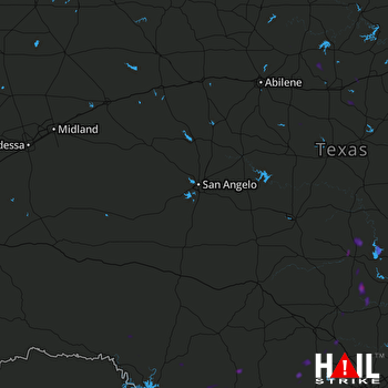 SAN ANGELO (KSJT) RADAR

