This weather event on August 27, 2024 includes:
2 states
15 counties,
24 cities,
and 64 zip codes.
There were 250 total properties that were impacted and have possible damage.
States Impacted By Hail On August 27, 2024
Minnesota
·
Wisconsin
Counties Impacted By Hail On August 27, 2024
Anoka, MN
·
Chisago, MN
·
Isanti, MN
·
Kanabec, MN
·
Pine, MN
·
Washington, MN
·
Ashland, WI
·
Barron, WI
·
Burnett, WI
·
Dunn, WI
·
Pierce, WI
·
Polk, WI
·
Sawyer, WI
·
St. Croix, WI
·
Washburn, WI
Cities Impacted By Hail On August 27, 2024
Balsam Lake, WI
·
Barron, WI
·
Bethel, MN
·
Cameron, WI
·
Centuria, WI
·
Chisago City, MN
·
Columbus, MN
·
Cottage Grove, MN
·
Cumberland, WI
·
Downsville, WI
·
Dresser, WI
·
East Bethel, MN
·
Ellsworth, WI
·
Grasston, MN
·
Lindstrom, MN
·
Little Round Lake, WI
·
New Richmond, WI
·
Oak Grove, MN
·
Rice Lake, WI
·
Spooner, WI
·
Stacy, MN
·
St. Francis, MN
·
Taylors Falls, MN
·
Wyoming, MN
Zip Codes Impacted By Hail On August 27, 2024
54003
·
54007
·
54011
·
54015
·
54017
·
54020
·
54022
·
54023
·
54024
·
54025
·
54026
·
54546
·
54552
·
54725
·
54728
·
54733
·
54734
·
54737
·
54739
·
54740
·
54751
·
54762
·
54763
·
54772
·
54801
·
54805
·
54810
·
54812
·
54817
·
54822
·
54824
·
54826
·
54829
·
54837
·
54840
·
54843
·
54853
·
54862
·
54868
·
54870
·
54871
·
54876
·
54889
·
54893
·
54896
·
55005
·
55006
·
55011
·
55012
·
55013
·
55016
·
55025
·
55030
·
55033
·
55040
·
55045
·
55063
·
55070
·
55074
·
55079
·
55084
·
55092
·
54527
·
54009
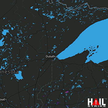 DULUTH (KDLH) RADAR

