This weather event on August 26, 2024 includes:
2 states
26 counties,
15 cities,
and 60 zip codes.
There were 283 total properties that were impacted and have possible damage.
States Impacted By Hail On August 26, 2024
Colorado
·
Kansas
Counties Impacted By Hail On August 26, 2024
Baca, CO
·
Cheyenne, CO
·
Kiowa, CO
·
Prowers, CO
·
Barton, KS
·
Decatur, KS
·
Gove, KS
·
Graham, KS
·
Greeley, KS
·
Hamilton, KS
·
Hodgeman, KS
·
Kearny, KS
·
Lane, KS
·
Logan, KS
·
Ness, KS
·
Pawnee, KS
·
Rice, KS
·
Rush, KS
·
Scott, KS
·
Sheridan, KS
·
Sherman, KS
·
Stafford, KS
·
Thomas, KS
·
Trego, KS
·
Wallace, KS
·
Wichita, KS
Cities Impacted By Hail On August 26, 2024
Alexander, KS
·
Brownell, KS
·
Collyer, KS
·
Ellinwood, KS
·
Gove City, KS
·
Grainfield, KS
·
Great Bend, KS
·
Greeley County unified government (balance), KS
·
Healy, KS
·
Holly, CO
·
Hoxie, KS
·
Larned, KS
·
Park, KS
·
Sheridan Lake, CO
·
Walsh, CO
Zip Codes Impacted By Hail On August 26, 2024
67513
·
67515
·
67516
·
67521
·
67523
·
67524
·
67526
·
67530
·
67545
·
67550
·
67556
·
67559
·
67560
·
67574
·
67575
·
67576
·
67584
·
67631
·
67635
·
67637
·
67642
·
67643
·
67656
·
67657
·
67659
·
67672
·
67701
·
67734
·
67735
·
67736
·
67737
·
67740
·
67747
·
67748
·
67751
·
67752
·
67753
·
67758
·
67761
·
67762
·
67764
·
67839
·
67849
·
67850
·
67857
·
67860
·
67861
·
67871
·
67878
·
67879
·
80802
·
81041
·
81047
·
81052
·
81071
·
81084
·
81090
·
67738
·
67645
·
67572
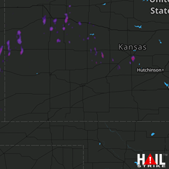 DODGE CITY (KDDC) RADAR

