This weather event on August 26, 2024 includes:
1 states
20 counties,
16 cities,
and 59 zip codes.
There were 412 total properties that were impacted and have possible damage.
States Impacted By Hail On August 26, 2024
Texas
Counties Impacted By Hail On August 26, 2024
Atascosa, TX
·
Bandera, TX
·
Bexar, TX
·
Blanco, TX
·
Burnet, TX
·
Comal, TX
·
Dimmit, TX
·
Duval, TX
·
Guadalupe, TX
·
Kendall, TX
·
Kerr, TX
·
La Salle, TX
·
Live Oak, TX
·
Llano, TX
·
Mason, TX
·
McMullen, TX
·
Medina, TX
·
Real, TX
·
Uvalde, TX
·
Wilson, TX
Cities Impacted By Hail On August 26, 2024
Bandera, TX
·
Blanco, TX
·
Canyon Lake, TX
·
Cibolo, TX
·
Comfort, TX
·
Floresville, TX
·
Garden Ridge, TX
·
Helotes, TX
·
Hollywood Park, TX
·
Horseshoe Bay, TX
·
Lakehills, TX
·
Lake Medina Shores, TX
·
New Braunfels, TX
·
Poth, TX
·
Schertz, TX
·
St. Hedwig, TX
Zip Codes Impacted By Hail On August 26, 2024
76831
·
76856
·
78003
·
78004
·
78006
·
78010
·
78011
·
78013
·
78014
·
78021
·
78022
·
78023
·
78026
·
78027
·
78028
·
78055
·
78056
·
78063
·
78065
·
78070
·
78072
·
78101
·
78108
·
78109
·
78113
·
78114
·
78124
·
78132
·
78133
·
78147
·
78152
·
78154
·
78217
·
78219
·
78220
·
78222
·
78232
·
78247
·
78254
·
78258
·
78259
·
78266
·
78357
·
78384
·
78606
·
78618
·
78624
·
78636
·
78643
·
78657
·
78663
·
78834
·
78836
·
78850
·
78861
·
78881
·
78883
·
78884
·
78885
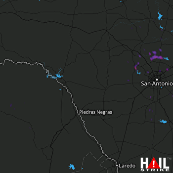 LAUGHLIN AFB (KDFX) RADAR

