This weather event on August 24, 2024 includes:
1 states
21 counties,
13 cities,
and 73 zip codes.
There were 349 total properties that were impacted and have possible damage.
States Impacted By Hail On August 24, 2024
Missouri
Counties Impacted By Hail On August 24, 2024
Barry, MO
·
Bates, MO
·
Benton, MO
·
Camden, MO
·
Cedar, MO
·
Christian, MO
·
Dade, MO
·
Dallas, MO
·
Greene, MO
·
Henry, MO
·
Hickory, MO
·
Johnson, MO
·
Lafayette, MO
·
Lawrence, MO
·
Morgan, MO
·
Pettis, MO
·
Polk, MO
·
St. Clair, MO
·
Stone, MO
·
Vernon, MO
·
Webster, MO
Cities Impacted By Hail On August 24, 2024
Arcola, MO
·
Bolivar, MO
·
Clever, MO
·
Deepwater, MO
·
Flemington, MO
·
Fremont Hills, MO
·
Ionia, MO
·
Ozark, MO
·
Republic, MO
·
Rogersville, MO
·
Smithton, MO
·
Springfield, MO
·
Strafford, MO
Zip Codes Impacted By Hail On August 24, 2024
64021
·
64067
·
64093
·
64735
·
64740
·
64744
·
64750
·
64770
·
64772
·
64776
·
64783
·
64788
·
64790
·
65037
·
65078
·
65301
·
65323
·
65324
·
65325
·
65326
·
65332
·
65333
·
65335
·
65338
·
65348
·
65350
·
65351
·
65355
·
65360
·
65601
·
65603
·
65604
·
65605
·
65610
·
65612
·
65613
·
65617
·
65619
·
65631
·
65633
·
65634
·
65635
·
65646
·
65648
·
65649
·
65650
·
65674
·
65682
·
65706
·
65710
·
65714
·
65721
·
65725
·
65738
·
65742
·
65746
·
65753
·
65757
·
65767
·
65770
·
65781
·
65785
·
65786
·
65787
·
65802
·
65803
·
65804
·
65809
·
64020
·
64037
·
64724
·
64780
·
65661
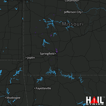 SPRINGFIELD (KSGF) RADAR

