This weather event on August 24, 2024 includes:
2 states
18 counties,
12 cities,
and 63 zip codes.
There were 465 total properties that were impacted and have possible damage.
States Impacted By Hail On August 24, 2024
Kansas
·
Nebraska
Counties Impacted By Hail On August 24, 2024
Clay, KS
·
Cloud, KS
·
Jewell, KS
·
Marshall, KS
·
Mitchell, KS
·
Phillips, KS
·
Pottawatomie, KS
·
Republic, KS
·
Riley, KS
·
Smith, KS
·
Washington, KS
·
Antelope, NE
·
Franklin, NE
·
Furnas, NE
·
Gosper, NE
·
Harlan, NE
·
Holt, NE
·
Webster, NE
Cities Impacted By Hail On August 24, 2024
Alma, NE
·
Bloomington, NE
·
Concordia, KS
·
Courtland, KS
·
Emmett, KS
·
Formoso, KS
·
Franklin, NE
·
Long Island, KS
·
Mankato, KS
·
Republican City, NE
·
Scandia, KS
·
Scottsville, KS
Zip Codes Impacted By Hail On August 24, 2024
66407
·
66411
·
66422
·
66427
·
66521
·
66536
·
66544
·
66547
·
66548
·
66549
·
66554
·
66901
·
66932
·
66935
·
66937
·
66938
·
66939
·
66940
·
66941
·
66942
·
66944
·
66948
·
66949
·
66951
·
66952
·
66953
·
66956
·
66958
·
66960
·
66962
·
66966
·
66967
·
66968
·
67417
·
67420
·
67430
·
67432
·
67437
·
67445
·
67446
·
67447
·
67468
·
67621
·
67638
·
67647
·
67661
·
68735
·
68764
·
68766
·
68773
·
68920
·
68929
·
68937
·
68939
·
68947
·
68960
·
68966
·
68970
·
68971
·
68972
·
68976
·
68977
·
68981
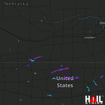 HASTINGS (KUEX) RADAR

