This weather event on August 22, 2024 includes:
2 states
23 counties,
25 cities,
and 86 zip codes.
There were 638 total properties that were impacted and have possible damage.
States Impacted By Hail On August 22, 2024
Kansas
·
Nebraska
Counties Impacted By Hail On August 22, 2024
Decatur, KS
·
Ellsworth, KS
·
Lincoln, KS
·
McPherson, KS
·
Mitchell, KS
·
Norton, KS
·
Osborne, KS
·
Phillips, KS
·
Rawlins, KS
·
Rice, KS
·
Rooks, KS
·
Russell, KS
·
Saline, KS
·
Smith, KS
·
Dawson, NE
·
Frontier, NE
·
Furnas, NE
·
Gosper, NE
·
Hayes, NE
·
Hitchcock, NE
·
Lincoln, NE
·
Phelps, NE
·
Red Willow, NE
Cities Impacted By Hail On August 22, 2024
Almena, KS
·
Cambridge, NE
·
Cozad, NE
·
Culbertson, NE
·
Curtis, NE
·
Danbury, NE
·
Gothenburg, NE
·
Herndon, KS
·
Kirwin, KS
·
Long Island, KS
·
Lucas, KS
·
Luray, KS
·
Lyons, KS
·
McCook, NE
·
Norton, KS
·
Phillipsburg, KS
·
Portis, KS
·
Prairie View, KS
·
Sterling, KS
·
Sylvan Grove, KS
·
Tipton, KS
·
Trenton, NE
·
Wellfleet, NE
·
Willow Island, NE
·
Wilsonville, NE
Zip Codes Impacted By Hail On August 22, 2024
66932
·
66951
·
66967
·
67401
·
67423
·
67425
·
67427
·
67430
·
67437
·
67439
·
67442
·
67443
·
67444
·
67454
·
67456
·
67457
·
67459
·
67460
·
67464
·
67473
·
67474
·
67481
·
67484
·
67485
·
67490
·
67491
·
67524
·
67554
·
67579
·
67621
·
67622
·
67623
·
67628
·
67629
·
67638
·
67639
·
67644
·
67645
·
67646
·
67647
·
67648
·
67649
·
67653
·
67654
·
67661
·
67664
·
67673
·
67675
·
67730
·
67739
·
67749
·
68850
·
68926
·
68937
·
68948
·
68949
·
69001
·
69020
·
69022
·
69024
·
69025
·
69026
·
69029
·
69032
·
69034
·
69036
·
69038
·
69039
·
69040
·
69042
·
69043
·
69044
·
69045
·
69046
·
69101
·
69123
·
69130
·
69132
·
69138
·
69151
·
69169
·
69170
·
69171
·
67428
·
67455
·
67744
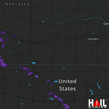 HASTINGS (KUEX) RADAR

