This weather event on August 21, 2024 includes:
3 states
27 counties,
22 cities,
and 78 zip codes.
There were total properties that were impacted and have possible damage.
States Impacted By Hail On August 21, 2024
Colorado
·
Kansas
·
Nebraska
Counties Impacted By Hail On August 21, 2024
Logan, CO
·
Phillips, CO
·
Sedgwick, CO
·
Washington, CO
·
Yuma, CO
·
Decatur, KS
·
Norton, KS
·
Osborne, KS
·
Phillips, KS
·
Rooks, KS
·
Rush, KS
·
Smith, KS
·
Arthur, NE
·
Chase, NE
·
Cheyenne, NE
·
Deuel, NE
·
Frontier, NE
·
Furnas, NE
·
Garden, NE
·
Harlan, NE
·
Hayes, NE
·
Hitchcock, NE
·
Keith, NE
·
Lincoln, NE
·
Perkins, NE
·
Phelps, NE
·
Red Willow, NE
Cities Impacted By Hail On August 21, 2024
Almena, KS
·
Amherst, CO
·
Belmar, NE
·
Big Springs, NE
·
Chappell, NE
·
Danbury, NE
·
Fleming, CO
·
Grant, NE
·
Haxtun, CO
·
Holyoke, CO
·
Kirwin, KS
·
Logan, KS
·
Long Island, KS
·
Madrid, NE
·
McCook, NE
·
Norton, KS
·
Ogallala, NE
·
Oshkosh, NE
·
Ovid, CO
·
Phillipsburg, KS
·
Prairie View, KS
·
Wallace, NE
Zip Codes Impacted By Hail On August 21, 2024
66951
·
67520
·
67548
·
67575
·
67621
·
67622
·
67623
·
67639
·
67644
·
67645
·
67646
·
67647
·
67653
·
67654
·
67664
·
67669
·
67675
·
67749
·
68926
·
68949
·
68971
·
68982
·
69001
·
69023
·
69024
·
69025
·
69026
·
69032
·
69034
·
69036
·
69040
·
69043
·
69044
·
69045
·
69046
·
69101
·
69121
·
69122
·
69127
·
69129
·
69132
·
69134
·
69140
·
69144
·
69146
·
69147
·
69148
·
69149
·
69150
·
69151
·
69154
·
69155
·
69162
·
69165
·
69168
·
69169
·
69170
·
80720
·
80721
·
80726
·
80728
·
80731
·
80734
·
80736
·
80737
·
80743
·
80744
·
80747
·
80749
·
80751
·
80759
·
80801
·
80812
·
80815
·
80822
·
67628
·
67661
·
69153
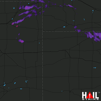 GOODLAND (KGLD) RADAR

