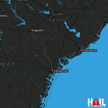
This weather event on August 18, 2024 includes:
2 states
27 counties,
11 cities,
and 58 zip codes.
There were 54 total properties that were impacted and have possible damage.
States Impacted By Hail On August 18, 2024
Georgia
·
South Carolina
Counties Impacted By Hail On August 18, 2024
Bryan, GA
·
Bulloch, GA
·
Candler, GA
·
Chatham, GA
·
Emanuel, GA
·
Jeff Davis, GA
·
Jefferson, GA
·
Johnson, GA
·
Laurens, GA
·
Montgomery, GA
·
Screven, GA
·
Toombs, GA
·
Treutlen, GA
·
Washington, GA
·
Wheeler, GA
·
Bamberg, SC
·
Barnwell, SC
·
Beaufort, SC
·
Berkeley, SC
·
Colleton, SC
·
Dorchester, SC
·
Florence, SC
·
Georgetown, SC
·
Jasper, SC
·
Kershaw, SC
·
Lancaster, SC
·
Orangeburg, SC
Cities Impacted By Hail On August 18, 2024
Bluffton, SC
·
Lyons, GA
·
Metter, GA
·
Olar, SC
·
Richmond Hill, GA
·
Savannah, GA
·
Statesboro, GA
·
Talahi Island, GA
·
Vernonburg, GA
·
Whitemarsh Island, GA
·
Wilmington Island, GA
Zip Codes Impacted By Hail On August 18, 2024
29003
·
29038
·
29067
·
29081
·
29133
·
29431
·
29432
·
29437
·
29448
·
29461
·
29469
·
29471
·
29472
·
29477
·
29481
·
29530
·
29554
·
29555
·
29583
·
29591
·
29812
·
29843
·
29849
·
29927
·
29945
·
30401
·
30410
·
30413
·
30425
·
30428
·
30439
·
30441
·
30445
·
30450
·
30454
·
30455
·
30457
·
30458
·
30461
·
30467
·
30470
·
30471
·
30473
·
30474
·
30477
·
31035
·
31049
·
31082
·
31089
·
31096
·
31324
·
31406
·
31410
·
31419
·
31539
·
31549
·
30436
·
29910
 CHARLESTON (KCLX) RADAR

