This weather event on August 18, 2024 includes:
3 states
19 counties,
30 cities,
and 77 zip codes.
There were 437 total properties that were impacted and have possible damage.
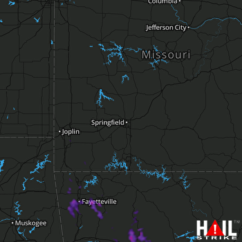 SPRINGFIELD (KSGF) RADAR
States Impacted By Hail On August 18, 2024
Arkansas
·
Missouri
·
Oklahoma
Counties Impacted By Hail On August 18, 2024
Benton, AR
·
Boone, AR
·
Carroll, AR
·
Conway, AR
·
Crawford, AR
·
Johnson, AR
·
Logan, AR
·
Madison, AR
·
Newton, AR
·
Pope, AR
·
Searcy, AR
·
Van Buren, AR
·
Washington, AR
·
Yell, AR
·
Barry, MO
·
McDonald, MO
·
Newton, MO
·
Adair, OK
·
Delaware, OK
Cities Impacted By Hail On August 18, 2024
Bella Vista, AR
·
Bentonville, AR
·
Bethel Heights, AR
·
Cave Springs, AR
·
Center Ridge, AR
·
Centerton, AR
·
Chewey, OK
·
Clarksville, AR
·
Dardanelle, AR
·
Farmington, AR
·
Fayetteville, AR
·
Flint Creek, OK
·
Goshen, AR
·
Gravette, AR
·
Greenland, AR
·
Hector, AR
·
Highfill, AR
·
Jasper, AR
·
Knoxville, AR
·
Lamar, AR
·
Lincoln, AR
·
Lowell, AR
·
Prairie Grove, AR
·
Rogers, AR
·
Springdale, AR
·
St. Paul, AR
·
Sulphur Springs, AR
·
Tontitown, AR
·
Western Grove, AR
·
West Fork, AR
Zip Codes Impacted By Hail On August 18, 2024
64840
·
64844
·
64850
·
65625
·
65647
·
65772
·
72027
·
72030
·
72063
·
72080
·
72156
·
72157
·
72611
·
72628
·
72633
·
72638
·
72641
·
72655
·
72679
·
72685
·
72686
·
72701
·
72703
·
72704
·
72712
·
72714
·
72715
·
72718
·
72719
·
72721
·
72727
·
72730
·
72734
·
72736
·
72738
·
72739
·
72740
·
72744
·
72745
·
72753
·
72756
·
72758
·
72760
·
72761
·
72762
·
72764
·
72768
·
72773
·
72774
·
72776
·
72802
·
72823
·
72830
·
72833
·
72834
·
72837
·
72839
·
72840
·
72843
·
72845
·
72846
·
72847
·
72852
·
72854
·
72856
·
72863
·
72934
·
72946
·
72959
·
74338
·
74347
·
74964
·
72851
·
72835
·
72683
·
72127
·
64867

