This weather event on August 17, 2024 includes:
2 states
21 counties,
15 cities,
and 59 zip codes.
There were 4756 total properties that were impacted and have possible damage.
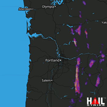 PORTLAND (KRTX) RADAR
States Impacted By Hail On August 17, 2024
Oregon
·
Washington
Counties Impacted By Hail On August 17, 2024
Clackamas, OR
·
Columbia, OR
·
Deschutes, OR
·
Hood River, OR
·
Jefferson, OR
·
Lane, OR
·
Linn, OR
·
Marion, OR
·
Multnomah, OR
·
Sherman, OR
·
Wasco, OR
·
Washington, OR
·
Clark, WA
·
Cowlitz, WA
·
King, WA
·
Kittitas, WA
·
Klickitat, WA
·
Lewis, WA
·
Pierce, WA
·
Skamania, WA
·
Yakima, WA
Cities Impacted By Hail On August 17, 2024
Biggs Junction, OR
·
Chenoweth, OR
·
Dallesport, WA
·
Government Camp, OR
·
Greenwater, WA
·
Idanha, OR
·
Lake Oswego, OR
·
Mount Hood Village, OR
·
North Bonneville, WA
·
Portland, OR
·
The Dalles, OR
·
Tigard, OR
·
Trout Lake, WA
·
Warm Springs, OR
·
Wishram, WA
Zip Codes Impacted By Hail On August 17, 2024
97011
·
97014
·
97021
·
97023
·
97028
·
97029
·
97031
·
97033
·
97034
·
97035
·
97037
·
97039
·
97040
·
97049
·
97050
·
97055
·
97056
·
97058
·
97063
·
97065
·
97067
·
97133
·
97219
·
97223
·
97231
·
97329
·
97350
·
97358
·
97413
·
97438
·
97463
·
97741
·
97759
·
97761
·
98022
·
98304
·
98323
·
98336
·
98361
·
98377
·
98564
·
98607
·
98610
·
98613
·
98616
·
98617
·
98620
·
98635
·
98639
·
98648
·
98649
·
98650
·
98672
·
98673
·
98675
·
98942
·
97342
·
97488
·
98356

