This weather event on August 17, 2024 includes:
1 states
20 counties,
18 cities,
and 68 zip codes.
There were 1513 total properties that were impacted and have possible damage.
States Impacted By Hail On August 17, 2024
Nebraska
Counties Impacted By Hail On August 17, 2024
Blaine, NE
·
Boone, NE
·
Butler, NE
·
Cass, NE
·
Colfax, NE
·
Custer, NE
·
Greeley, NE
·
Howard, NE
·
Lancaster, NE
·
Logan, NE
·
Merrick, NE
·
Nance, NE
·
Otoe, NE
·
Platte, NE
·
Polk, NE
·
Saunders, NE
·
Seward, NE
·
Sherman, NE
·
Thomas, NE
·
Valley, NE
Cities Impacted By Hail On August 17, 2024
Alvo, NE
·
Anselmo, NE
·
Bee, NE
·
David City, NE
·
Eagle, NE
·
Fullerton, NE
·
Genoa, NE
·
Lincoln, NE
·
North Loup, NE
·
Otoe, NE
·
Raymond, NE
·
Rising City, NE
·
Schuyler, NE
·
Scotia, NE
·
Shelby, NE
·
Surprise, NE
·
Ulysses, NE
·
Waverly, NE
Zip Codes Impacted By Hail On August 17, 2024
68014
·
68036
·
68050
·
68065
·
68304
·
68307
·
68314
·
68346
·
68347
·
68349
·
68360
·
68402
·
68417
·
68418
·
68423
·
68428
·
68434
·
68439
·
68446
·
68454
·
68462
·
68504
·
68514
·
68517
·
68521
·
68524
·
68527
·
68531
·
68601
·
68620
·
68623
·
68627
·
68628
·
68632
·
68635
·
68638
·
68640
·
68642
·
68647
·
68651
·
68653
·
68658
·
68660
·
68662
·
68663
·
68666
·
68667
·
68669
·
68813
·
68815
·
68817
·
68822
·
68826
·
68828
·
68833
·
68838
·
68842
·
68859
·
68862
·
68864
·
68874
·
68875
·
68882
·
69142
·
69166
·
68001
·
68336
·
68661
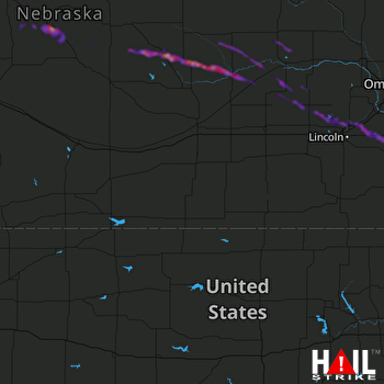 HASTINGS (KUEX) RADAR

