This weather event on August 15, 2024 includes:
5 states
24 counties,
28 cities,
and 66 zip codes.
There were 160 total properties that were impacted and have possible damage.
States Impacted By Hail On August 15, 2024
Illinois
·
Indiana
·
Kentucky
·
Missouri
·
Tennessee
Counties Impacted By Hail On August 15, 2024
Alexander, IL
·
Jackson, IL
·
Johnson, IL
·
Massac, IL
·
Pope, IL
·
Pulaski, IL
·
Union, IL
·
Gibson, IN
·
Lawrence, IN
·
Ballard, KY
·
Calloway, KY
·
Carlisle, KY
·
Graves, KY
·
Larue, KY
·
Livingston, KY
·
Marshall, KY
·
McCracken, KY
·
Trigg, KY
·
Cape Girardeau, MO
·
Mississippi, MO
·
Perry, MO
·
Stoddard, MO
·
Benton, TN
·
Stewart, TN
Cities Impacted By Hail On August 15, 2024
Altenburg, MO
·
Alto Pass, IL
·
Anna, IL
·
Baker, MO
·
Bandana, KY
·
Benton, KY
·
Cairo, IL
·
Calvert City, KY
·
Cobden, IL
·
Cypress, IL
·
Frohna, MO
·
Gorham, IL
·
Grand Tower, IL
·
Hardin, KY
·
Hendron, KY
·
Jonesboro, IL
·
Kevil, KY
·
Ledbetter, KY
·
Massac, KY
·
Mounds, IL
·
New Grand Chain, IL
·
Olive Branch, IL
·
Paducah, KY
·
Patoka, IN
·
Princeton, IN
·
Pulaski, IL
·
Symsonia, KY
·
Tamms, IL
Zip Codes Impacted By Hail On August 15, 2024
37058
·
37175
·
38221
·
42001
·
42003
·
42022
·
42023
·
42024
·
42025
·
42027
·
42029
·
42035
·
42036
·
42048
·
42051
·
42053
·
42056
·
42058
·
42071
·
42076
·
42081
·
42082
·
42086
·
42716
·
42748
·
47446
·
47470
·
47649
·
47666
·
47670
·
62905
·
62906
·
62908
·
62910
·
62912
·
62914
·
62920
·
62923
·
62926
·
62940
·
62941
·
62942
·
62950
·
62952
·
62956
·
62962
·
62963
·
62964
·
62969
·
62970
·
62975
·
62976
·
62988
·
62992
·
62995
·
62996
·
62998
·
63732
·
63748
·
63755
·
63769
·
63770
·
63783
·
63834
·
63846
·
62280
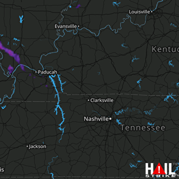 FORT CAMPBELL (KHPX) RADAR

