This weather event on August 12, 2024 includes:
5 states
28 counties,
17 cities,
and 87 zip codes.
There were 63 total properties that were impacted and have possible damage.
States Impacted By Hail On August 12, 2024
Iowa
·
Kansas
·
Missouri
·
Nebraska
·
Oklahoma
Counties Impacted By Hail On August 12, 2024
Mills, IA
·
Page, IA
·
Butler, KS
·
Chase, KS
·
Chautauqua, KS
·
Cowley, KS
·
Elk, KS
·
Greenwood, KS
·
Harvey, KS
·
Marion, KS
·
Montgomery, KS
·
Reno, KS
·
Sedgwick, KS
·
Sumner, KS
·
Wabaunsee, KS
·
Andrew, MO
·
Caldwell, MO
·
Carroll, MO
·
Clinton, MO
·
Daviess, MO
·
DeKalb, MO
·
Johnson, MO
·
Lafayette, MO
·
Ray, MO
·
Cass, NE
·
Otoe, NE
·
Sarpy, NE
·
Osage, OK
Cities Impacted By Hail On August 12, 2024
Burrton, KS
·
Cameron, MO
·
Cedar Creek, NE
·
Corder, MO
·
Dexter, KS
·
Dover, MO
·
Elmira, MO
·
Halstead, KS
·
Hamilton, KS
·
Hardin, MO
·
Plattsmouth, NE
·
Polo, MO
·
Rosendale, MO
·
Springfield, NE
·
Turney, MO
·
Warrensburg, MO
·
Winfield, KS
Zip Codes Impacted By Hail On August 12, 2024
51533
·
51540
·
51601
·
51645
·
64011
·
64020
·
64021
·
64077
·
64084
·
64085
·
64093
·
64096
·
64097
·
64429
·
64465
·
64469
·
64474
·
64477
·
64483
·
64485
·
64493
·
64624
·
64633
·
64637
·
64644
·
64649
·
64650
·
64668
·
64671
·
66834
·
66840
·
66850
·
66853
·
66861
·
66869
·
67019
·
67020
·
67038
·
67042
·
67045
·
67056
·
67063
·
67114
·
67119
·
67132
·
67135
·
67137
·
67147
·
67152
·
67154
·
67156
·
67344
·
67349
·
67352
·
67355
·
67360
·
67361
·
67501
·
67510
·
67522
·
67566
·
67568
·
67579
·
67581
·
68016
·
68028
·
68037
·
68046
·
68048
·
68059
·
68123
·
68133
·
68346
·
68446
·
68448
·
74022
·
74056
·
74652
·
64022
·
64035
·
64036
·
64037
·
64062
·
64067
·
64074
·
67024
·
67123
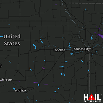 TOPEKA (KTWX) RADAR

