This weather event on August 10, 2024 includes:
2 states
29 counties,
16 cities,
and 78 zip codes.
There were 630 total properties that were impacted and have possible damage.
States Impacted By Hail On August 10, 2024
North Carolina
·
Virginia
Counties Impacted By Hail On August 10, 2024
Beaufort, NC
·
Bertie, NC
·
Camden, NC
·
Carteret, NC
·
Chowan, NC
·
Craven, NC
·
Currituck, NC
·
Duplin, NC
·
Halifax, NC
·
Hertford, NC
·
Jones, NC
·
Lenoir, NC
·
Martin, NC
·
Northampton, NC
·
Onslow, NC
·
Pamlico, NC
·
Pitt, NC
·
Wayne, NC
·
Brunswick, VA
·
Chesapeake, VA
·
Dinwiddie, VA
·
Emporia, VA
·
Greensville, VA
·
Isle of Wight, VA
·
Mecklenburg, VA
·
Southampton, VA
·
Suffolk, VA
·
Surry, VA
·
Sussex, VA
Cities Impacted By Hail On August 10, 2024
Chesapeake, VA
·
Edenton, NC
·
Emporia, VA
·
Grimesland, NC
·
Harrellsville, NC
·
Jackson, NC
·
Jackson Heights, NC
·
Kinston, NC
·
Mount Olive, NC
·
Moyock, NC
·
Murfreesboro, NC
·
Severn, NC
·
Simpson, NC
·
South Hill, VA
·
Suffolk, VA
·
Wakefield, VA
Zip Codes Impacted By Hail On August 10, 2024
23322
·
23323
·
23432
·
23434
·
23435
·
23487
·
23828
·
23833
·
23841
·
23844
·
23847
·
23850
·
23857
·
23866
·
23867
·
23878
·
23882
·
23888
·
23890
·
23893
·
23894
·
23897
·
23920
·
23950
·
23970
·
27817
·
27818
·
27820
·
27829
·
27831
·
27834
·
27837
·
27839
·
27845
·
27853
·
27855
·
27858
·
27862
·
27869
·
27876
·
27879
·
27889
·
27892
·
27910
·
27923
·
27929
·
27932
·
27942
·
27946
·
27956
·
27958
·
27976
·
27980
·
27983
·
28341
·
28365
·
28398
·
28501
·
28504
·
28516
·
28520
·
28526
·
28530
·
28532
·
28551
·
28556
·
28562
·
28571
·
28572
·
28573
·
28574
·
28578
·
28585
·
28586
·
28560
·
27973
·
27917
·
23837
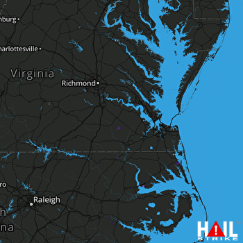 NORFOLK/RICH (KAKQ) RADAR

