This weather event on August 7, 2024 includes:
4 states
25 counties,
18 cities,
and 88 zip codes.
There were 948 total properties that were impacted and have possible damage.
States Impacted By Hail On August 7, 2024
Kentucky
·
Pennsylvania
·
Virginia
·
West Virginia
Counties Impacted By Hail On August 7, 2024
Estill, KY
·
Fayette, PA
·
Greene, PA
·
Bath, VA
·
Dickenson, VA
·
Russell, VA
·
Barbour, WV
·
Boone, WV
·
Braxton, WV
·
Cabell, WV
·
Clay, WV
·
Doddridge, WV
·
Harrison, WV
·
Kanawha, WV
·
Lewis, WV
·
Lincoln, WV
·
Marion, WV
·
Mingo, WV
·
Monongalia, WV
·
Putnam, WV
·
Raleigh, WV
·
Roane, WV
·
Upshur, WV
·
Wayne, WV
·
Webster, WV
Cities Impacted By Hail On August 7, 2024
Barrackville, WV
·
Belle, WV
·
Burnsville, WV
·
Charleston, WV
·
Chesapeake, WV
·
Culloden, WV
·
Dunbar, WV
·
Glasgow, WV
·
Handley, WV
·
Hurricane, WV
·
Marmet, WV
·
Masontown, PA
·
Nitro, WV
·
Pratt, WV
·
Salt Rock, WV
·
South Charleston, WV
·
Teays Valley, WV
·
Winfield, WV
Zip Codes Impacted By Hail On August 7, 2024
15338
·
15461
·
15478
·
24225
·
24226
·
24237
·
24266
·
24487
·
25015
·
25024
·
25035
·
25043
·
25049
·
25054
·
25064
·
25067
·
25075
·
25086
·
25102
·
25103
·
25107
·
25110
·
25126
·
25134
·
25140
·
25143
·
25156
·
25162
·
25165
·
25168
·
25177
·
25181
·
25213
·
25214
·
25259
·
25276
·
25301
·
25303
·
25304
·
25306
·
25311
·
25312
·
25313
·
25314
·
25315
·
25506
·
25510
·
25512
·
25514
·
25517
·
25526
·
25559
·
25560
·
25570
·
25571
·
25671
·
25674
·
26201
·
26217
·
26234
·
26267
·
26321
·
26335
·
26338
·
26339
·
26378
·
26411
·
26412
·
26426
·
26447
·
26452
·
26456
·
26501
·
26508
·
26554
·
26559
·
26571
·
26601
·
26621
·
26627
·
26631
·
40336
·
40472
·
24460
·
25061
·
25523
·
26222
·
26385
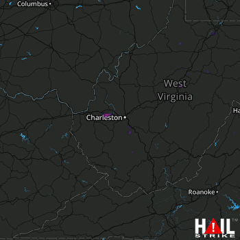 CHARLESTON (KRLX) RADAR

