This weather event on August 5, 2024 includes:
3 states
19 counties,
27 cities,
and 81 zip codes.
There were total properties that were impacted and have possible damage.
States Impacted By Hail On August 5, 2024
Iowa
·
Minnesota
·
Wisconsin
Counties Impacted By Hail On August 5, 2024
Allamakee, IA
·
Bremer, IA
·
Buchanan, IA
·
Butler, IA
·
Chickasaw, IA
·
Clayton, IA
·
Fayette, IA
·
Floyd, IA
·
Winneshiek, IA
·
Houston, MN
·
Crawford, WI
·
Dane, WI
·
Grant, WI
·
Iowa, WI
·
Jefferson, WI
·
Lafayette, WI
·
Richland, WI
·
Sauk, WI
·
Vernon, WI
Cities Impacted By Hail On August 5, 2024
Avoca, WI
·
Barneveld, WI
·
Blue Mounds, WI
·
Boscobel, WI
·
Clayton, IA
·
Decorah, IA
·
Eastman, WI
·
Ferryville, WI
·
Frederika, IA
·
Harpers Ferry, IA
·
Lake Mills, WI
·
Livingston, WI
·
Lone Rock, WI
·
Lynxville, WI
·
Maynard, IA
·
Mineral Point, WI
·
Mount Horeb, WI
·
Nashua, IA
·
New Albin, IA
·
Ridgeway, WI
·
Steuben, WI
·
Sumner, IA
·
Waterville, IA
·
Waukon, IA
·
Wauzeka, WI
·
Westgate, IA
·
Woodman, WI
Zip Codes Impacted By Hail On August 5, 2024
50606
·
50607
·
50616
·
50619
·
50629
·
50630
·
50645
·
50650
·
50655
·
50658
·
50659
·
50662
·
50666
·
50674
·
50676
·
50677
·
50681
·
52049
·
52076
·
52101
·
52140
·
52142
·
52151
·
52160
·
52170
·
52172
·
53503
·
53504
·
53506
·
53507
·
53510
·
53515
·
53517
·
53518
·
53528
·
53530
·
53531
·
53533
·
53543
·
53544
·
53551
·
53553
·
53554
·
53556
·
53559
·
53565
·
53569
·
53572
·
53573
·
53580
·
53581
·
53582
·
53588
·
53593
·
53594
·
53801
·
53805
·
53807
·
53811
·
53813
·
53818
·
53821
·
53826
·
53827
·
53924
·
54624
·
54626
·
54628
·
54631
·
54634
·
54655
·
54657
·
54667
·
55919
·
55921
·
55931
·
54619
·
53809
·
52146
·
50671
·
50636
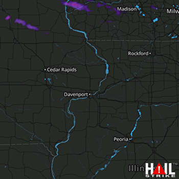 DAVENPORT (KDVN) RADAR

