This weather event on August 5, 2024 includes:
2 states
7 counties,
35 cities,
and 42 zip codes.
There were total properties that were impacted and have possible damage.
States Impacted By Hail On August 5, 2024
Illinois
·
Indiana
Counties Impacted By Hail On August 5, 2024
Cook, IL
·
Kankakee, IL
·
Will, IL
·
Lake, IN
·
LaPorte, IN
·
Porter, IN
·
Starke, IN
Cities Impacted By Hail On August 5, 2024
Aberdeen, IN
·
Beverly Shores, IN
·
Burns Harbor, IN
·
Chesterton, IN
·
Chicago Heights, IL
·
Crete, IL
·
Dune Acres, IN
·
Frankfort, IL
·
Gary, IN
·
Grant Park, IL
·
Hanna, IN
·
Hobart, IN
·
Kingsbury, IN
·
Kingsford Heights, IN
·
Lake Station, IN
·
La Porte, IN
·
Manhattan, IL
·
Manteno, IL
·
Momence, IL
·
Monee, IL
·
New Chicago, IN
·
Park Forest, IL
·
Peotone, IL
·
Portage, IN
·
Porter, IN
·
Salt Creek Commons, IN
·
Sauk Village, IL
·
South Chicago Heights, IL
·
South Haven, IN
·
Steger, IL
·
St. John, IN
·
Valparaiso, IN
·
Wanatah, IN
·
Wheeler, IN
·
Willowbrook, IL
Zip Codes Impacted By Hail On August 5, 2024
46301
·
46304
·
46311
·
46340
·
46342
·
46345
·
46346
·
46348
·
46350
·
46356
·
46360
·
46368
·
46382
·
46383
·
46385
·
46390
·
46393
·
46403
·
46404
·
46405
·
46406
·
46407
·
46409
·
46532
·
46534
·
46574
·
60401
·
60411
·
60417
·
60423
·
60442
·
60449
·
60466
·
60468
·
60475
·
60481
·
60901
·
60914
·
60940
·
60950
·
60954
·
46402
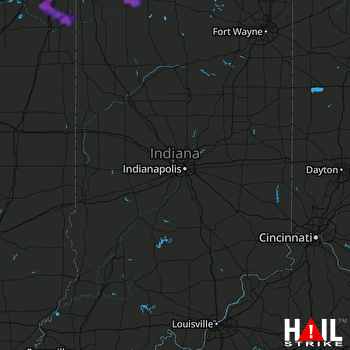 INDIANAPOLIS (KIND) RADAR

