This weather event on August 4, 2024 includes:
2 states
14 counties,
26 cities,
and 49 zip codes.
There were 17544 total properties that were impacted and have possible damage.
States Impacted By Hail On August 4, 2024
Michigan
·
Wisconsin
Counties Impacted By Hail On August 4, 2024
Lake, MI
·
Manistee, MI
·
Mason, MI
·
Newaygo, MI
·
Brown, WI
·
Calumet, WI
·
Door, WI
·
Kewaunee, WI
·
Manitowoc, WI
·
Oconto, WI
·
Outagamie, WI
·
Shawano, WI
·
Waushara, WI
·
Winnebago, WI
Cities Impacted By Hail On August 4, 2024
Appleton, WI
·
Combined Locks, WI
·
Dale, WI
·
Eastlake, MI
·
Filer City, MI
·
Forest Junction, WI
·
Forestville, WI
·
Fountain, MI
·
Free Soil, MI
·
Harrison, WI
·
Kaukauna, WI
·
Kimberly, WI
·
Little Chute, WI
·
Little Sturgeon, WI
·
Ludington, MI
·
Manistee, MI
·
Maribel, WI
·
Menasha, WI
·
Oak Hill, MI
·
Oconto, WI
·
Parkdale, MI
·
Scottville, MI
·
Stronach, MI
·
Sturgeon Bay, WI
·
Tustin, WI
·
Winchester, WI
Zip Codes Impacted By Hail On August 4, 2024
49304
·
49309
·
49402
·
49405
·
49410
·
49411
·
49431
·
49454
·
49626
·
49634
·
49660
·
54106
·
54107
·
54110
·
54113
·
54123
·
54126
·
54129
·
54130
·
54136
·
54140
·
54141
·
54153
·
54162
·
54165
·
54201
·
54204
·
54208
·
54213
·
54227
·
54230
·
54235
·
54904
·
54911
·
54913
·
54914
·
54915
·
54923
·
54931
·
54940
·
54942
·
54944
·
54947
·
54952
·
54982
·
54984
·
54986
·
54956
·
49458
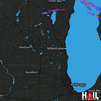 MILWAUKEE (KMKX) RADAR

