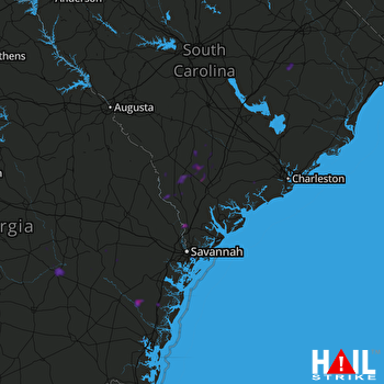
This weather event on August 2, 2024 includes:
2 states
27 counties,
23 cities,
and 67 zip codes.
There were 790 total properties that were impacted and have possible damage.
States Impacted By Hail On August 2, 2024
Georgia
·
South Carolina
Counties Impacted By Hail On August 2, 2024
Appling, GA
·
Bryan, GA
·
Chatham, GA
·
Effingham, GA
·
Glynn, GA
·
Jeff Davis, GA
·
Liberty, GA
·
Long, GA
·
McIntosh, GA
·
Montgomery, GA
·
Screven, GA
·
Tattnall, GA
·
Telfair, GA
·
Toombs, GA
·
Wayne, GA
·
Wheeler, GA
·
Allendale, SC
·
Bamberg, SC
·
Beaufort, SC
·
Charleston, SC
·
Clarendon, SC
·
Colleton, SC
·
Dorchester, SC
·
Florence, SC
·
Hampton, SC
·
Jasper, SC
·
Williamsburg, SC
Cities Impacted By Hail On August 2, 2024
Dutch Island, GA
·
Estill, SC
·
Furman, SC
·
Glennville, GA
·
Hampton, SC
·
Hardeeville, SC
·
Hazlehurst, GA
·
Islandton, SC
·
Lodge, SC
·
Ravenel, SC
·
Ridgeland, SC
·
Rincon, GA
·
Savannah, GA
·
Scotia, SC
·
Smoaks, SC
·
St. George, SC
·
Talahi Island, GA
·
Thunderbolt, GA
·
Varnville, SC
·
Whitemarsh Island, GA
·
Williams, SC
·
Wilmington Island, GA
·
Yemassee, SC
Zip Codes Impacted By Hail On August 2, 2024
29081
·
29082
·
29111
·
29161
·
29162
·
29426
·
29432
·
29435
·
29437
·
29449
·
29470
·
29474
·
29475
·
29477
·
29481
·
29488
·
29493
·
29518
·
29541
·
29560
·
29810
·
29827
·
29909
·
29911
·
29918
·
29921
·
29922
·
29923
·
29924
·
29927
·
29929
·
29932
·
29934
·
29939
·
29943
·
29944
·
29945
·
30411
·
30417
·
30421
·
30428
·
30436
·
30446
·
30453
·
30467
·
30474
·
31060
·
31302
·
31303
·
31309
·
31316
·
31326
·
31331
·
31404
·
31406
·
31410
·
31411
·
31419
·
31513
·
31523
·
31539
·
31544
·
31546
·
31549
·
29916
·
29936
·
30427
 CHARLESTON (KCLX) RADAR

