This weather event on July 31, 2024 includes:
2 states
16 counties,
32 cities,
and 76 zip codes.
There were 1240 total properties that were impacted and have possible damage.
States Impacted By Hail On July 31, 2024
Minnesota
·
Wisconsin
Counties Impacted By Hail On July 31, 2024
Aitkin, MN
·
Anoka, MN
·
Benton, MN
·
Cass, MN
·
Crow Wing, MN
·
Hennepin, MN
·
Hubbard, MN
·
Itasca, MN
·
Kanabec, MN
·
Koochiching, MN
·
Mille Lacs, MN
·
Morrison, MN
·
Pine, MN
·
St. Louis, MN
·
Wright, MN
·
Polk, WI
Cities Impacted By Hail On July 31, 2024
Aitkin, MN
·
Annandale, MN
·
Brainerd, MN
·
Breezy Point, MN
·
Buffalo, MN
·
Chisholm, MN
·
Cohasset, MN
·
Coleraine, MN
·
Columbus, MN
·
Crosslake, MN
·
East Bethel, MN
·
Edina, MN
·
Fifty Lakes, MN
·
Grand Rapids, MN
·
Ham Lake, MN
·
Hibbing, MN
·
Hopkins, MN
·
Kinney, MN
·
La Prairie, MN
·
Little Falls, MN
·
Manhattan Beach, MN
·
Maple Lake, MN
·
Minneapolis, MN
·
Minnetonka, MN
·
Pease, MN
·
Richfield, MN
·
Riverton, MN
·
St. Croix Falls, WI
·
St. Louis Park, MN
·
Taconite, MN
·
Trommald, MN
·
Vineland, MN
Zip Codes Impacted By Hail On July 31, 2024
54024
·
54810
·
54824
·
54837
·
54853
·
55006
·
55011
·
55025
·
55030
·
55051
·
55063
·
55092
·
55302
·
55304
·
55313
·
55343
·
55358
·
55371
·
55410
·
55416
·
55419
·
55423
·
55424
·
55426
·
55435
·
55436
·
55439
·
55709
·
55719
·
55721
·
55723
·
55725
·
55736
·
55742
·
55744
·
55746
·
55748
·
55760
·
55768
·
55769
·
55771
·
55785
·
55787
·
56330
·
56345
·
56350
·
56353
·
56359
·
56363
·
56364
·
56367
·
56373
·
56386
·
56401
·
56431
·
56441
·
56442
·
56444
·
56447
·
56450
·
56455
·
56465
·
56468
·
56469
·
56472
·
56474
·
56628
·
56636
·
56649
·
56653
·
56657
·
56662
·
56678
·
55710
·
55758
·
56338
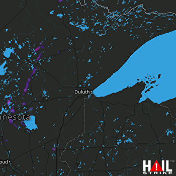 DULUTH (KDLH) RADAR

