This weather event on July 30, 2024 includes:
1 states
22 counties,
16 cities,
and 80 zip codes.
There were 1026 total properties that were impacted and have possible damage.
States Impacted By Hail On July 30, 2024
Kansas
Counties Impacted By Hail On July 30, 2024
Barton, KS
·
Butler, KS
·
Chase, KS
·
Edwards, KS
·
Ellis, KS
·
Franklin, KS
·
Greenwood, KS
·
Harvey, KS
·
Kingman, KS
·
Lyon, KS
·
Marion, KS
·
Morris, KS
·
Osage, KS
·
Pawnee, KS
·
Pratt, KS
·
Reno, KS
·
Rice, KS
·
Rush, KS
·
Russell, KS
·
Sedgwick, KS
·
Stafford, KS
·
Wabaunsee, KS
Cities Impacted By Hail On July 30, 2024
Andale, KS
·
Burns, KS
·
Cedar Point, KS
·
Cheney, KS
·
Colwich, KS
·
Garden Plain, KS
·
Haven, KS
·
Kechi, KS
·
Maize, KS
·
Ottawa, KS
·
Park City, KS
·
Pomona, KS
·
South Hutchinson, KS
·
Valley Center, KS
·
Whitewater, KS
·
Wichita, KS
Zip Codes Impacted By Hail On July 30, 2024
66033
·
66042
·
66067
·
66076
·
66078
·
66079
·
66080
·
66413
·
66431
·
66510
·
66528
·
66801
·
66833
·
66838
·
66840
·
66843
·
66846
·
66850
·
66851
·
66852
·
66854
·
66858
·
66860
·
66861
·
66862
·
66865
·
66869
·
66873
·
67001
·
67020
·
67025
·
67026
·
67028
·
67030
·
67035
·
67042
·
67050
·
67052
·
67056
·
67068
·
67101
·
67106
·
67108
·
67111
·
67114
·
67118
·
67123
·
67124
·
67132
·
67134
·
67135
·
67147
·
67154
·
67203
·
67204
·
67205
·
67223
·
67235
·
67501
·
67514
·
67519
·
67520
·
67526
·
67529
·
67543
·
67550
·
67559
·
67565
·
67568
·
67570
·
67573
·
67575
·
67581
·
67583
·
67640
·
67665
·
67671
·
67505
·
67149
·
66845
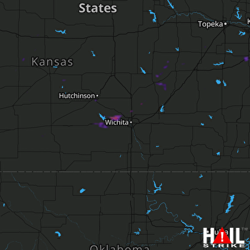 WICHITA (KICT) RADAR

