This weather event on July 28, 2024 includes:
4 states
22 counties,
16 cities,
and 48 zip codes.
There were total properties that were impacted and have possible damage.
States Impacted By Hail On July 28, 2024
Iowa
·
Illinois
·
Missouri
·
Wisconsin
Counties Impacted By Hail On July 28, 2024
Henry, IA
·
Iowa, IA
·
Keokuk, IA
·
Lee, IA
·
Adams, IL
·
Brown, IL
·
Fulton, IL
·
Hancock, IL
·
McDonough, IL
·
Morgan, IL
·
Ogle, IL
·
Pike, IL
·
Schuyler, IL
·
Scott, IL
·
Whiteside, IL
·
Lewis, MO
·
Marion, MO
·
Ralls, MO
·
Shelby, MO
·
Juneau, WI
·
Lafayette, WI
·
Rock, WI
Cities Impacted By Hail On July 28, 2024
Bluffs, IL
·
Bushnell, IL
·
Chapin, IL
·
Exeter, IL
·
Florence, IL
·
Jacksonville, IL
·
Lima, IL
·
Loraine, IL
·
Marietta, IL
·
Milton, WI
·
Naples, IL
·
Plymouth, IL
·
Sigourney, IA
·
South Wayne, WI
·
Valley City, IL
·
West Point, IL
Zip Codes Impacted By Hail On July 28, 2024
52316
·
52591
·
52625
·
52645
·
52656
·
53534
·
53545
·
53563
·
53587
·
53948
·
53968
·
61010
·
61047
·
61252
·
61422
·
61452
·
61455
·
61459
·
61477
·
62316
·
62319
·
62323
·
62326
·
62340
·
62343
·
62348
·
62349
·
62351
·
62353
·
62356
·
62363
·
62367
·
62370
·
62373
·
62376
·
62378
·
62380
·
62621
·
62628
·
62650
·
62665
·
62694
·
63434
·
63438
·
63440
·
63454
·
63459
·
63463
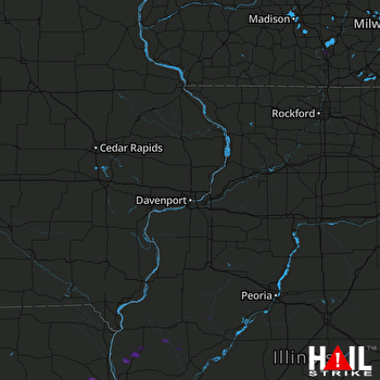 DAVENPORT (KDVN) RADAR

