This weather event on July 28, 2024 includes:
2 states
25 counties,
10 cities,
and 73 zip codes.
There were total properties that were impacted and have possible damage.
States Impacted By Hail On July 28, 2024
Kansas
·
Nebraska
Counties Impacted By Hail On July 28, 2024
Butler, KS
·
Cloud, KS
·
Cowley, KS
·
Ellsworth, KS
·
Harvey, KS
·
Jewell, KS
·
Lincoln, KS
·
Marion, KS
·
McPherson, KS
·
Mitchell, KS
·
Osborne, KS
·
Ottawa, KS
·
Reno, KS
·
Republic, KS
·
Rice, KS
·
Russell, KS
·
Saline, KS
·
Sedgwick, KS
·
Clay, NE
·
Fillmore, NE
·
Nuckolls, NE
·
Seward, NE
·
Thayer, NE
·
Webster, NE
·
York, NE
Cities Impacted By Hail On July 28, 2024
Clay Center, NE
·
Downs, KS
·
Falun, KS
·
Florence, KS
·
Glasco, KS
·
Hebron, NE
·
Marquette, KS
·
McPherson, KS
·
Rose Hill, KS
·
Salina, KS
Zip Codes Impacted By Hail On July 28, 2024
66851
·
66861
·
66901
·
67056
·
67107
·
67131
·
67133
·
67135
·
67146
·
67156
·
67401
·
67416
·
67418
·
67420
·
67422
·
67423
·
67425
·
67436
·
67437
·
67439
·
67442
·
67444
·
67445
·
67448
·
67454
·
67455
·
67456
·
67457
·
67460
·
67464
·
67467
·
67470
·
67474
·
67480
·
67481
·
67484
·
67490
·
67491
·
67522
·
67570
·
67626
·
67634
·
67665
·
67673
·
68313
·
68326
·
68335
·
68351
·
68370
·
68436
·
68460
·
68930
·
68933
·
68934
·
68942
·
68957
·
68961
·
68964
·
68978
·
68979
·
67546
·
67473
·
67039
·
67037
·
67020
·
67008
·
66966
·
66964
·
66942
·
66939
·
66938
·
66935
·
66930
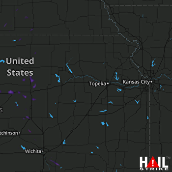 TOPEKA (KTWX) RADAR

