This weather event on July 27, 2024 includes:
3 states
20 counties,
21 cities,
and 71 zip codes.
There were 2733 total properties that were impacted and have possible damage.
States Impacted By Hail On July 27, 2024
Kansas
·
Missouri
·
Nebraska
Counties Impacted By Hail On July 27, 2024
Anderson, KS
·
Atchison, KS
·
Bourbon, KS
·
Coffey, KS
·
Douglas, KS
·
Franklin, KS
·
Jackson, KS
·
Johnson, KS
·
Leavenworth, KS
·
Linn, KS
·
Miami, KS
·
Wyandotte, KS
·
Atchison, MO
·
Bates, MO
·
Cass, MO
·
Clay, MO
·
Jackson, MO
·
Vernon, MO
·
Nemaha, NE
·
Richardson, NE
Cities Impacted By Hail On July 27, 2024
Baldwin City, KS
·
Blue Mound, KS
·
Bonner Springs, KS
·
Cleveland, MO
·
Edgerton, KS
·
Fontana, KS
·
Gardner, KS
·
Garnett, KS
·
Gladstone, MO
·
Kansas City, MO
·
La Cygne, KS
·
Lee's Summit, MO
·
Lenexa, KS
·
Mapleton, KS
·
Olathe, KS
·
Osawatomie, KS
·
Overland Park, KS
·
Pleasanton, KS
·
Shawnee, KS
·
Tonganoxie, KS
·
West Line, MO
Zip Codes Impacted By Hail On July 27, 2024
64080
·
64082
·
64083
·
64116
·
64118
·
64482
·
64701
·
64720
·
64722
·
64723
·
64725
·
64734
·
64742
·
66002
·
66006
·
66010
·
66012
·
66013
·
66014
·
66020
·
66021
·
66025
·
66030
·
66032
·
66033
·
66040
·
66044
·
66046
·
66047
·
66048
·
66052
·
66053
·
66054
·
66056
·
66061
·
66062
·
66064
·
66067
·
66071
·
66072
·
66075
·
66080
·
66086
·
66092
·
66095
·
66111
·
66217
·
66218
·
66220
·
66221
·
66226
·
66227
·
66409
·
66509
·
66701
·
66738
·
66754
·
66767
·
66839
·
66854
·
66856
·
66857
·
68321
·
68355
·
68421
·
68457
·
68433
·
66779
·
66026
·
64778
·
64496
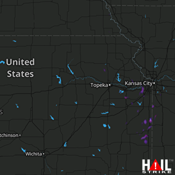 TOPEKA (KTWX) RADAR

