This weather event on July 25, 2024 includes:
3 states
30 counties,
19 cities,
and 72 zip codes.
There were total properties that were impacted and have possible damage.
States Impacted By Hail On July 25, 2024
Illinois
·
Kentucky
·
Missouri
Counties Impacted By Hail On July 25, 2024
Alexander, IL
·
Clay, IL
·
Gallatin, IL
·
Johnson, IL
·
Massac, IL
·
Pope, IL
·
Pulaski, IL
·
Richland, IL
·
Saline, IL
·
Union, IL
·
Wayne, IL
·
White, IL
·
Williamson, IL
·
Ballard, KY
·
McCracken, KY
·
Benton, MO
·
Bollinger, MO
·
Boone, MO
·
Cape Girardeau, MO
·
Chariton, MO
·
Howard, MO
·
Macon, MO
·
Monroe, MO
·
Perry, MO
·
Pettis, MO
·
Pike, MO
·
Ralls, MO
·
Randolph, MO
·
Reynolds, MO
·
Wayne, MO
Cities Impacted By Hail On July 25, 2024
Anna, IL
·
Bandana, KY
·
Buncombe, IL
·
Cape Girardeau, MO
·
Carrier Mills, IL
·
Cole Camp, MO
·
Creal Springs, IL
·
Gordonville, MO
·
Harrisburg, IL
·
Jackson, MO
·
Jonesboro, IL
·
Joppa, IL
·
Marion, IL
·
Mill Creek, IL
·
Mound City, IL
·
Olive Branch, IL
·
Pulaski, IL
·
Tamms, IL
·
Ullin, IL
Zip Codes Impacted By Hail On July 25, 2024
42024
·
42053
·
42056
·
62446
·
62823
·
62824
·
62842
·
62869
·
62871
·
62906
·
62908
·
62912
·
62917
·
62922
·
62923
·
62926
·
62930
·
62934
·
62935
·
62939
·
62941
·
62946
·
62947
·
62952
·
62953
·
62956
·
62959
·
62960
·
62961
·
62963
·
62964
·
62969
·
62970
·
62972
·
62974
·
62976
·
62987
·
62988
·
62992
·
62995
·
62996
·
63339
·
63382
·
63532
·
63552
·
63638
·
63665
·
63701
·
63732
·
63748
·
63750
·
63751
·
63755
·
63934
·
63944
·
63951
·
63956
·
63964
·
65201
·
65230
·
65239
·
65244
·
65247
·
65259
·
65260
·
65281
·
65325
·
65345
·
65350
·
42022
·
62868
·
63462
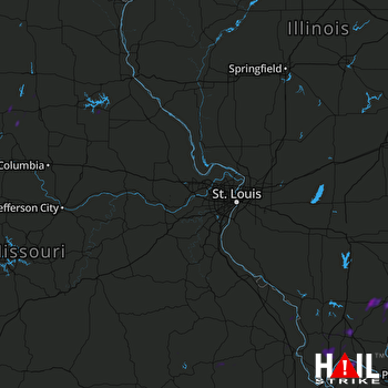 ST LOUIS (KLSX) RADAR

