This weather event on July 24, 2024 includes:
2 states
13 counties,
26 cities,
and 59 zip codes.
There were total properties that were impacted and have possible damage.
States Impacted By Hail On July 24, 2024
Illinois
·
Indiana
Counties Impacted By Hail On July 24, 2024
Edgar, IL
·
Vermilion, IL
·
Fountain, IN
·
Hancock, IN
·
Hendricks, IN
·
Johnson, IN
·
Marion, IN
·
Montgomery, IN
·
Morgan, IN
·
Parke, IN
·
Putnam, IN
·
Shelby, IN
·
Vermillion, IN
Cities Impacted By Hail On July 24, 2024
Avon, IN
·
Bargersville, IN
·
Bethany, IN
·
Brooklyn, IN
·
Brownsburg, IN
·
Clermont, IN
·
Crawfordsville, IN
·
Crows Nest, IN
·
Cumberland, IN
·
Danville, IN
·
Franklin, IN
·
Greencastle, IN
·
Greenwood, IN
·
Indianapolis city (balance), IN
·
Meridian Hills, IN
·
Monrovia, IN
·
Mooresville, IN
·
New Whiteland, IN
·
North Crows Nest, IN
·
North Salem, IN
·
Perrysville, IN
·
Ridge Farm, IL
·
Speedway, IN
·
Whiteland, IN
·
Williams Creek, IN
·
Wynnedale, IN
Zip Codes Impacted By Hail On July 24, 2024
46106
·
46110
·
46111
·
46112
·
46113
·
46120
·
46121
·
46122
·
46123
·
46124
·
46126
·
46128
·
46131
·
46135
·
46140
·
46143
·
46149
·
46151
·
46157
·
46158
·
46160
·
46162
·
46163
·
46165
·
46167
·
46172
·
46176
·
46180
·
46181
·
46184
·
46208
·
46214
·
46219
·
46220
·
46222
·
46224
·
46228
·
46229
·
46234
·
46237
·
46239
·
46250
·
46254
·
46259
·
46260
·
46268
·
47834
·
47928
·
47933
·
47940
·
47952
·
47954
·
47974
·
47987
·
61850
·
61870
·
47932
·
46240
·
46118
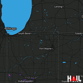 FORT WAYNE (KIWX) RADAR

