This weather event on July 24, 2024 includes:
2 states
24 counties,
28 cities,
and 78 zip codes.
There were 3199 total properties that were impacted and have possible damage.
States Impacted By Hail On July 24, 2024
Iowa
·
Illinois
Counties Impacted By Hail On July 24, 2024
Benton, IA
·
Black Hawk, IA
·
Bremer, IA
·
Buchanan, IA
·
Chickasaw, IA
·
Delaware, IA
·
Grundy, IA
·
Hardin, IA
·
Jasper, IA
·
Jones, IA
·
Linn, IA
·
Marshall, IA
·
Poweshiek, IA
·
Tama, IA
·
Grundy, IL
·
Kankakee, IL
·
Kendall, IL
·
Knox, IL
·
LaSalle, IL
·
Lee, IL
·
Livingston, IL
·
Mercer, IL
·
Putnam, IL
·
Will, IL
Cities Impacted By Hail On July 24, 2024
Albion, IA
·
Braceville, IL
·
Braidwood, IL
·
Cedar Rapids, IA
·
Conrad, IA
·
Eldora, IA
·
Ely, IA
·
Essex, IL
·
Fairfax, IA
·
Ferguson, IA
·
Green Mountain, IA
·
Hiawatha, IA
·
Kangley, IL
·
Liscomb, IA
·
Lostant, IL
·
Marion, IA
·
Marshalltown, IA
·
Plainfield, IA
·
Robins, IA
·
Standard, IL
·
Steamboat Rock, IA
·
Streator, IL
·
Symerton, IL
·
Tonica, IL
·
Union, IA
·
Walford, IA
·
Wellsburg, IA
·
Whitten, IA
Zip Codes Impacted By Hail On July 24, 2024
50005
·
50078
·
50106
·
50112
·
50148
·
50158
·
50206
·
50258
·
50601
·
50609
·
50621
·
50626
·
50627
·
50629
·
50632
·
50635
·
50638
·
50641
·
50645
·
50648
·
50658
·
50666
·
50672
·
50677
·
50680
·
50703
·
52206
·
52213
·
52218
·
52227
·
52228
·
52233
·
52237
·
52302
·
52305
·
52310
·
52313
·
52315
·
52318
·
52328
·
52336
·
52339
·
52341
·
52402
·
52404
·
60408
·
60416
·
60424
·
60444
·
60450
·
60479
·
60481
·
60518
·
60531
·
60541
·
60549
·
60551
·
60917
·
60935
·
60961
·
61311
·
61313
·
61318
·
61319
·
61326
·
61334
·
61341
·
61348
·
61350
·
61353
·
61354
·
61360
·
61363
·
61364
·
61370
·
61465
·
61472
·
52202
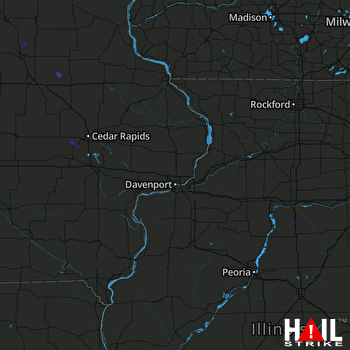 DAVENPORT (KDVN) RADAR

