This weather event on July 24, 2024 includes:
2 states
22 counties,
14 cities,
and 65 zip codes.
There were 65 total properties that were impacted and have possible damage.
States Impacted By Hail On July 24, 2024
Iowa
·
Minnesota
Counties Impacted By Hail On July 24, 2024
Benton, IA
·
Black Hawk, IA
·
Buchanan, IA
·
Butler, IA
·
Cedar, IA
·
Cerro Gordo, IA
·
Chickasaw, IA
·
Clayton, IA
·
Emmet, IA
·
Fayette, IA
·
Floyd, IA
·
Franklin, IA
·
Grundy, IA
·
Hancock, IA
·
Humboldt, IA
·
Johnson, IA
·
Jones, IA
·
Kossuth, IA
·
Linn, IA
·
Palo Alto, IA
·
Winnebago, IA
·
Martin, MN
Cities Impacted By Hail On July 24, 2024
Armstrong, IA
·
Cedar Rapids, IA
·
Duncan, IA
·
Ely, IA
·
Garner, IA
·
Livermore, IA
·
Palo, IA
·
Sheffield, IA
·
Shellsburg, IA
·
St. Joseph, IA
·
Swea City, IA
·
Thompson, IA
·
Wallingford, IA
·
West Branch, IA
Zip Codes Impacted By Hail On July 24, 2024
50423
·
50424
·
50428
·
50433
·
50436
·
50438
·
50449
·
50450
·
50453
·
50475
·
50478
·
50479
·
50480
·
50482
·
50484
·
50511
·
50514
·
50519
·
50522
·
50528
·
50531
·
50536
·
50539
·
50556
·
50558
·
50559
·
50570
·
50578
·
50590
·
50598
·
50606
·
50613
·
50644
·
50650
·
50651
·
50658
·
50660
·
50665
·
51334
·
51342
·
51365
·
52076
·
52210
·
52213
·
52227
·
52228
·
52240
·
52253
·
52305
·
52313
·
52324
·
52332
·
52333
·
52341
·
52349
·
52358
·
52401
·
52402
·
52403
·
52404
·
52405
·
52411
·
56031
·
56121
·
50597
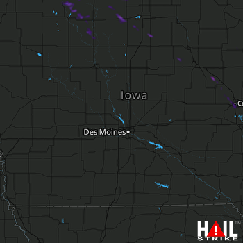 DES MOINES (KDMX) RADAR

