This weather event on July 24, 2024 includes:
2 states
14 counties,
21 cities,
and 52 zip codes.
There were total properties that were impacted and have possible damage.
States Impacted By Hail On July 24, 2024
Iowa
·
Minnesota
Counties Impacted By Hail On July 24, 2024
Butler, IA
·
Cerro Gordo, IA
·
Emmet, IA
·
Floyd, IA
·
Franklin, IA
·
Hancock, IA
·
Humboldt, IA
·
Kossuth, IA
·
Mitchell, IA
·
Palo Alto, IA
·
Winnebago, IA
·
Worth, IA
·
Wright, IA
·
Martin, MN
Cities Impacted By Hail On July 24, 2024
Algona, IA
·
Armstrong, IA
·
Crystal Lake, IA
·
Duncan, IA
·
Garner, IA
·
Goodell, IA
·
Greene, IA
·
Hanlontown, IA
·
Hardy, IA
·
Irvington, IA
·
Klemme, IA
·
Livermore, IA
·
Lu Verne, IA
·
Manly, IA
·
Meservey, IA
·
Ringsted, IA
·
Sheffield, IA
·
St. Joseph, IA
·
Swea City, IA
·
Thompson, IA
·
Woden, IA
Zip Codes Impacted By Hail On July 24, 2024
50421
·
50423
·
50424
·
50428
·
50432
·
50433
·
50436
·
50438
·
50439
·
50441
·
50444
·
50446
·
50448
·
50449
·
50450
·
50453
·
50456
·
50457
·
50458
·
50461
·
50464
·
50475
·
50478
·
50479
·
50480
·
50482
·
50484
·
50511
·
50514
·
50517
·
50519
·
50522
·
50525
·
50528
·
50531
·
50536
·
50539
·
50542
·
50545
·
50556
·
50558
·
50559
·
50560
·
50578
·
50590
·
50597
·
50598
·
50636
·
51334
·
51342
·
51365
·
56031
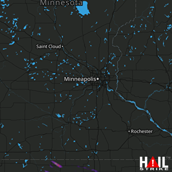 MINNEAPOLIS (KMPX) RADAR

