This weather event on July 23, 2024 includes:
2 states
23 counties,
20 cities,
and 62 zip codes.
There were 286 total properties that were impacted and have possible damage.
States Impacted By Hail On July 23, 2024
Iowa
·
Minnesota
Counties Impacted By Hail On July 23, 2024
Benton, IA
·
Black Hawk, IA
·
Clay, IA
·
Dickinson, IA
·
Emmet, IA
·
Hamilton, IA
·
Hardin, IA
·
Henry, IA
·
Humboldt, IA
·
Iowa, IA
·
Jones, IA
·
Kossuth, IA
·
Linn, IA
·
Marshall, IA
·
Palo Alto, IA
·
Pocahontas, IA
·
Story, IA
·
Winnebago, IA
·
Worth, IA
·
Wright, IA
·
Freeborn, MN
·
Jackson, MN
·
Martin, MN
Cities Impacted By Hail On July 23, 2024
Alburnett, IA
·
Anamosa, IA
·
Arnolds Park, IA
·
Center Point, IA
·
Conroy, IA
·
Dunnell, MN
·
La Porte City, IA
·
Milford, IA
·
Mount Auburn, IA
·
Newhall, IA
·
New London, IA
·
Okoboji, IA
·
Orleans, IA
·
Plover, IA
·
South Amana, IA
·
Spirit Lake, IA
·
Van Horne, IA
·
Vinton, IA
·
Wahpeton, IA
·
West Okoboji, IA
Zip Codes Impacted By Hail On July 23, 2024
50075
·
50130
·
50132
·
50230
·
50246
·
50271
·
50278
·
50450
·
50459
·
50514
·
50531
·
50533
·
50562
·
50570
·
50573
·
50581
·
50595
·
50597
·
50599
·
50651
·
51301
·
51331
·
51333
·
51334
·
51351
·
51355
·
51360
·
51364
·
51365
·
52202
·
52205
·
52206
·
52213
·
52214
·
52220
·
52229
·
52236
·
52301
·
52302
·
52313
·
52315
·
52318
·
52320
·
52334
·
52336
·
52341
·
52346
·
52349
·
52623
·
52645
·
56007
·
56009
·
56029
·
56031
·
56036
·
56121
·
56127
·
56143
·
50206
·
52310
·
52361
·
56111
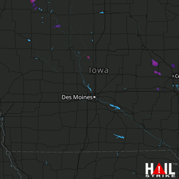 DES MOINES (KDMX) RADAR

