This weather event on July 22, 2024 includes:
4 states
22 counties,
14 cities,
and 64 zip codes.
There were 32 total properties that were impacted and have possible damage.
States Impacted By Hail On July 22, 2024
Iowa
·
Kansas
·
Nebraska
·
South Dakota
Counties Impacted By Hail On July 22, 2024
Boone, IA
·
Clarke, IA
·
Dallas, IA
·
Page, IA
·
Taylor, IA
·
Clay, KS
·
Cloud, KS
·
Jewell, KS
·
Marshall, KS
·
Republic, KS
·
Washington, KS
·
Butler, NE
·
Clay, NE
·
Fillmore, NE
·
Gage, NE
·
Jefferson, NE
·
Lancaster, NE
·
Nuckolls, NE
·
Seward, NE
·
Thayer, NE
·
Lincoln, SD
·
Turner, SD
Cities Impacted By Hail On July 22, 2024
Clyde, KS
·
Endicott, NE
·
Fairbury, NE
·
Hardy, NE
·
Hepburn, IA
·
Hollenberg, KS
·
Home, KS
·
Jansen, NE
·
Marysville, KS
·
Nelson, NE
·
New Market, IA
·
Oketo, KS
·
Pleasant Dale, NE
·
Superior, NE
Zip Codes Impacted By Hail On July 22, 2024
50003
·
50212
·
50213
·
50233
·
50275
·
50833
·
50848
·
50864
·
51632
·
51646
·
57004
·
57014
·
57029
·
57036
·
57043
·
57053
·
66412
·
66438
·
66508
·
66518
·
66901
·
66937
·
66938
·
66945
·
66946
·
66964
·
66970
·
67432
·
67447
·
67468
·
68065
·
68303
·
68310
·
68318
·
68322
·
68325
·
68326
·
68342
·
68350
·
68352
·
68377
·
68402
·
68415
·
68423
·
68424
·
68428
·
68436
·
68466
·
68524
·
68626
·
68632
·
68635
·
68669
·
68934
·
68935
·
68938
·
68941
·
68943
·
68957
·
68961
·
68978
·
68440
·
68360
·
50264
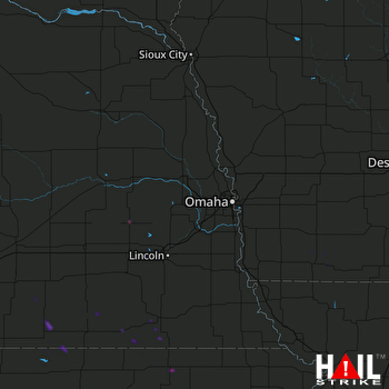 OMAHA (KOAX) RADAR

