This weather event on July 22, 2024 includes:
3 states
32 counties,
18 cities,
and 84 zip codes.
There were 107 total properties that were impacted and have possible damage.
States Impacted By Hail On July 22, 2024
Iowa
·
Minnesota
·
Missouri
Counties Impacted By Hail On July 22, 2024
Appanoose, IA
·
Boone, IA
·
Cedar, IA
·
Clarke, IA
·
Dallas, IA
·
Davis, IA
·
Dickinson, IA
·
Grundy, IA
·
Hamilton, IA
·
Hardin, IA
·
Jefferson, IA
·
Jones, IA
·
Keokuk, IA
·
Linn, IA
·
Lucas, IA
·
Marshall, IA
·
Monroe, IA
·
Page, IA
·
Polk, IA
·
Story, IA
·
Tama, IA
·
Van Buren, IA
·
Wapello, IA
·
Warren, IA
·
Washington, IA
·
Wayne, IA
·
Wright, IA
·
Adair, MO
·
Nodaway, MO
·
Putnam, MO
·
Schuyler, MO
·
Sullivan, MO
Cities Impacted By Hail On July 22, 2024
Ames, IA
·
Buckeye, IA
·
Cedar Rapids, IA
·
Coin, IA
·
Des Moines, IA
·
Ellsworth, IA
·
Gilbert, IA
·
Greencastle, MO
·
Johnston, IA
·
Keosauqua, IA
·
Lake Park, IA
·
Marion, IA
·
Nevada, IA
·
Pleasant Hill, IA
·
Robins, IA
·
Story City, IA
·
Urbandale, IA
·
Windsor Heights, IA
Zip Codes Impacted By Hail On July 22, 2024
50006
·
50008
·
50010
·
50014
·
50047
·
50049
·
50056
·
50060
·
50068
·
50075
·
50105
·
50125
·
50126
·
50130
·
50131
·
50151
·
50158
·
50201
·
50212
·
50213
·
50230
·
50233
·
50236
·
50238
·
50248
·
50264
·
50278
·
50310
·
50311
·
50317
·
50320
·
50322
·
50324
·
50599
·
50632
·
50635
·
50638
·
50642
·
50680
·
51347
·
51360
·
51630
·
51632
·
51636
·
52216
·
52255
·
52302
·
52323
·
52328
·
52353
·
52402
·
52501
·
52531
·
52533
·
52535
·
52537
·
52540
·
52544
·
52549
·
52552
·
52554
·
52555
·
52556
·
52565
·
52569
·
52571
·
52572
·
52585
·
52593
·
52651
·
52777
·
63501
·
63535
·
63544
·
63546
·
63551
·
63559
·
63565
·
64423
·
64468
·
64655
·
50275
·
50327
·
52594
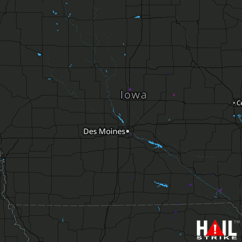 DES MOINES (KDMX) RADAR

